My husband and I will soon be off on our tenth anniversary trip. We decided to climb Mount Rainier, at 14,410 ft. To prepare, we decided we should hike one mountain peak a month, and we've amazingly been able to stick to that training plan.
In April we hiked Crystal Peak, 7,108 ft, 2.5 miles round trip, a few hundred ft elevation gain.
In May we hiked Wheeler Peak, 13,063 ft, eight miles round trip, about 3,000 ft elevation gain.
In June we hiked Mount Moriah, 12,050 ft, 7.5 miles round trip, about 2,000 ft elevation gain.
In July we hiked Pyramid Peak, 11,998 ft, 8 miles round trip, 3,900 ft elevation gain.
And in August we hiked North Schell Peak, 11,883 ft, 6 miles round trip, 2,800 ft elevation gain.
Here's the story of the North Schell Peak trip, a peak I really enjoyed.
The night before we stayed at the Timber Creek campground. Since it's not far from Ely, we fully expected it to be full, but only two other campsites (of about 11 there) had tents up. Each site had a concrete pad, fire pit, picnic table, and lots of space. Potable water and pit toilets were nearby.
It was a chilly night, and we woke to frost on our packs. So we got up, left the tent in place, drove to the end of the road, and started hiking. We followed an old road through the aspens.
The old road followed Timber Creek as it curved to the north. The scenery was gorgeous.
The trail climbed steadily along the drainage. I hadn't even expected a trail so far up, so was very pleasantly surprised. The creek went dry, but we did find an occasional spring.
I even found a few ferns in a cool, moist spot.
And also a deer skeleton. Even though it's bow season, we didn't see any hunters.
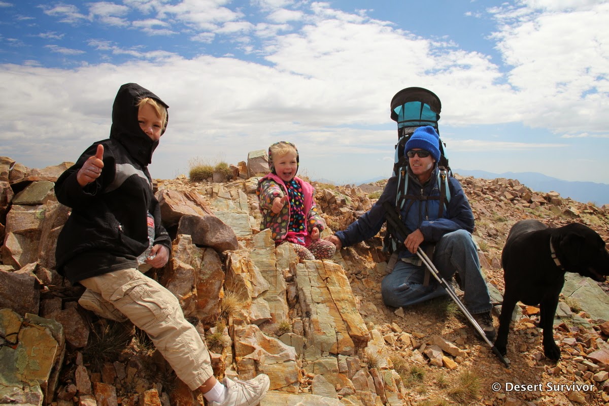
The trail petered out as the creek bed merged into alpine slopes. We stopped for one of many snack breaks and snapped a quick family photo (I've learned not to wait until the top!).
Then we knew we just needed to go up. A gentle ridge beckoned us.
The lupine was still blooming, although some seed looked ready.
We found some wood up high on the slope, above any trees, indicating that the forest used to be up higher on the slopes.
Although Desert Girl was carried for about 500 ft elevation gain, she did most of the hike. One technique that was particularly effective was for her to share her dad's hiking poles. When he moved a pole forward, that helped propel her forward.
Desert Boy was charging ahead to the summit, except that what he thought was the summit was a false summit. It was a hard lesson to learn. Fortunately the bribe of pizza after the hike helped rekindle everyone's spirits. Plus as we got higher, the scenery was so dramatic.
Finally we only had the last ridge to climb, past the small wind shelter.
I got distracted by the alpine plants, which are so diminutive due to their short growing season and harsh conditions they have to withstand.
When I looked up from photographing plants, I saw my husband and kids making good progress.
The ridge had looked so sharp from below, but was not at all hard to hike up. We were glad we had our coats, it was cold!
And then we were there! Even our dog Henry made it.
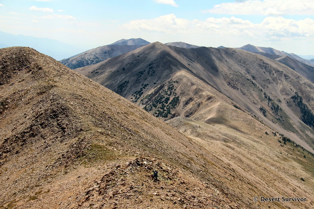
Of course the top isn't the end of the hike, it's only halfway! We still had to get back to the vehicle. We debated going back the way we had come (which would have been a good idea and easier) or following the ridge and taking the straight line down. Since we seem to be suckers for taking the hike less traveled, we followed the ridge.
A huge group of ravens hung out in the leeward side of a saddle.
The buckwheat was beautiful.
Someday I'd like to hike a lot more of the crest. The Schell Creek Range is 142 miles long. I don't think I need to hike all that, but a few more miles would be beautiful.
Can you spot the people? We didn't see anyone else on our entire hike. The register from mid-July had seven people signed in. Nevertheless, North Schell Peak is a popular peak with those wanting to hike peaks with greater than 5,000 feet prominence. (Here's a list of ultra-prominent peaks in the lower 48).
It was blustery on our way down.

Although the landscape views are superb, I like taking in the little details, too, like the little wasp. It had a variety of flowers to visit.
Some of the quartzite rocks had interesting patterns in them.
And here's a pretty butterfly.
The scenery was absolutely spectacular. Have I mentioned that already? I know that I certainly never pictured Nevada looking like some of it does. The Basin and Range topography makes for a huge diversity of habitats.
Before long we reached a huge aspen grove, with most of the aspens bent due to winter snows.
It took us four hours to get up and about 2.5 hours to get down, with a round-trip total of close to six miles. It could certainly be done faster if you didn't need to take as many snack breaks!
Before we left the canyon, we had to stop at the playground. Yes, Timber Creek campground has a playground!
I hope to get back to the Schell Creek Range to do some more hiking. It is gorgeous and uncrowded.


1 comment:
Hi from Utah. I've heard a lot about the Schells so thank you for this blog with hiking directions. Love your desert adventures with your kids and the bribe of pizza! I'll try that with my teenagers. Safe travels, Linnea
Post a Comment