Showing posts with label water. Show all posts

Tuesday, June 17, 2025

Sub-alpine Lakes Loop and Bristlecone Trails, Great Basin National Park

We had family in town, it was the end of May, and it was time to check out some of the higher elevation trails! With only about 65% snowpack for the 2024-2025 winter, the Wheeler Peak Scenic Drive opened just before Memorial Day weekend, allowing easier access to the snowy trails.

We started in the parking lot with some silliness.

Then it was time for the before photo. We were prepared with hiking poles and microspikes for most. Footwear and clothing varied.

This stump chair is always a favorite!

We found a lot of snow on the trail to Stella Lake.

 Fortunately the snow lessened as we got on more south-facing slopes.

I was surprised to see so much ice still on the lake. The snow above it looked patchy.

The trail between Stella and Teresa Lakes was about 60% covered in snow. Fortunately someone who knew what they were doing made the first tracks, which lined up with the orange trail markers on the trees.

When we got to Teresa Lake, we saw that it was about double the size from a few days previous, but still small. The inlet stream was barely flowing.

Then our group split, with some going on to the bristlecones. The north-facing slope was quite treacherous.

My nephew fell, but fortunately stayed on the trail. And he even smiled!

When we turned the corner, the conditions improved a lot, and soon we were in the bristleone grove, admiring these old beings.


And why not give the tree a hug?


I also encouraged touching the bottlebrush-like needles. They feel so nice.

It was definitely good we had microspikes this early in the season. A couple weeks later and they weren't needed. 

The Bristlecone Trail and Sub-alpine Lakes Loop are two of the busiest trails in the park, and for good reason, they are beautiful. Fortunately, Great Basin National Park doesn't have super high visitation, so you can still have a true national park experience. However, parking is limited, and on weekends and holidays, it's best to arrive before 9:30 am or after 3:30 pm to snag a parking spot.

Wednesday, December 4, 2024

Return to Crystal Ball Cave

Our friends organized a trip to Crystal Ball Cave and we were happy to join them. This cave is so different and wonderful. We started by going down the Lombardy poplar-lined driveway, where we spotted some peacocks and deer. After meeting our guide Kirsten, we drove up the hill and started on the 15-minute hike to the cave entrance.


Kirsten told us about how her family had discovered the cave while looking for lost sheep. They don't remember what happened to the sheep, but they sure remembered the cave!

The entrance is through a small door.

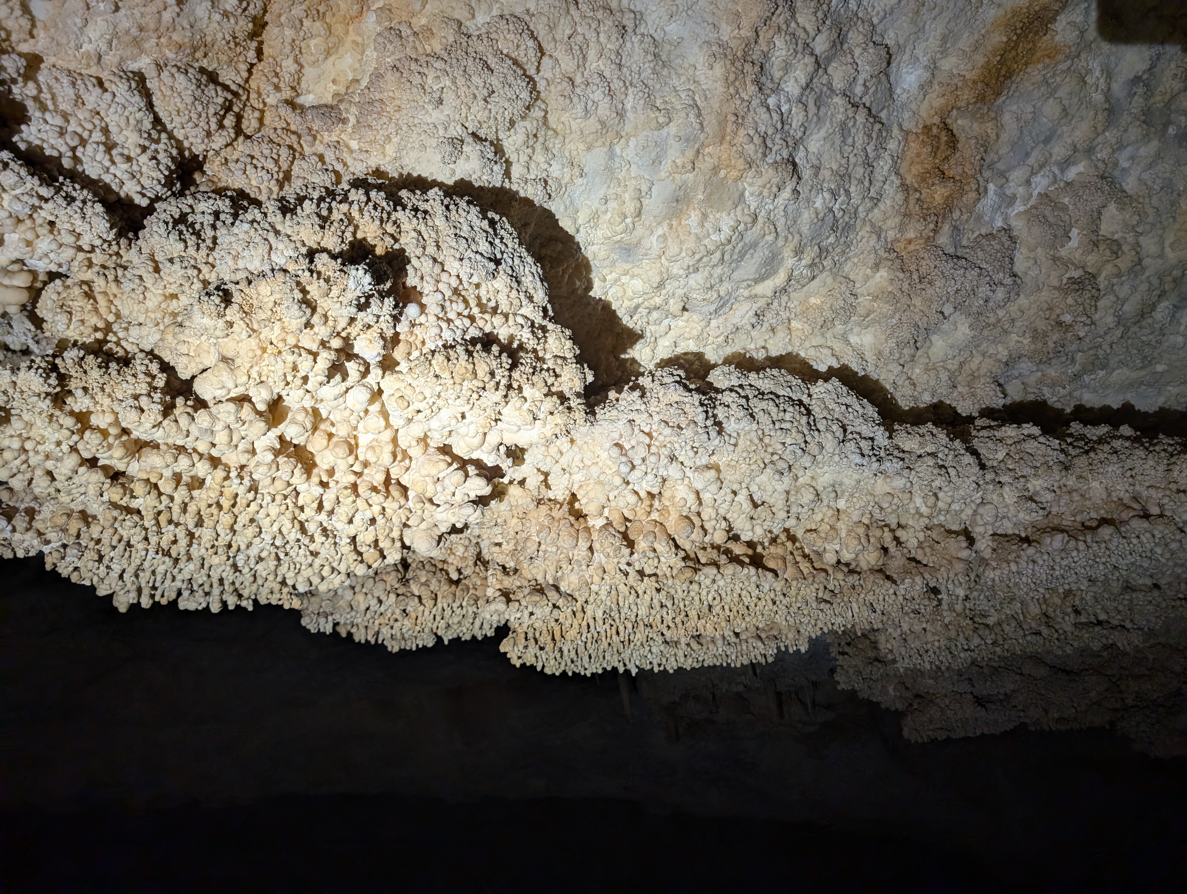
And then you're in the giant geode! Crystal Ball has thick crystal coatings on most of the ceilings, walls, and floors, caused by supersaturated water. Check out the big crystal by Kirsten's feet!

I've passed this weird looking stalactite several times. Now I understand that it's condensation corrosion that has been weathering away the formation so that we can see the layers that were deposited earlier.

You bring your own lights to light up the cave. Kirsten had a super bright light that really lit up a lot. As you can see, we're walking on the natural cave floor.

I looked closely at this formation. It might resemble a stalagmite at first, but I've seen several of these in Lehman Caves that have a hole through the middle. Sure enough, this one did, too. A gypsum bed was probably at this height, and water drips made a hole into the highly dissolvable gypsum. Then the water splashed to make the popcorny look. So maybe coralloid-encrusted drip tube is a better term for this speleothem. What would you call it?

Gypsum, you say? Why yes, there's a bunch of it in the cave. I don't understand why. You can see drill holes through a bunch of it from dripping water. Why does it confound me? I will be the first to say I have limited geologic knowledge. But I know that gypsum is soluble by water. And in order to have the nailhead spar (crystal coating) in the cave, the cave had to be flooded with water. So that means the gypsum came later. What made it come?

Up on the ceilings are lots of trays, flat surfaces of popcorn. Here's one explanation of how they form (on a really cool website called The Virtual Cave): http://www.goodearthgraphics.com/virtcave/trays/trays.html

There are plenty of more "regular" speleothems, like this nice stalagmite.

And quite a few stalactites and a large stalagmite with draperies on it.

This old ladder heads up into one of the many cupolas in the cave. Cupolas are like upside down sinkholes--they are bigger on the bottom and then get smaller on the top. They form from warm, acidic water rising from below. Cupolas are one of the indications of hypogenic caves, and the more I look at caves in the West, the more I see signs of hypogenesis. Many caves back east, like Mammoth Cave, are epigenic caves, forming when streams sink underground or water flows down sinkholes.

Continuing along, we passed more splattermites and more crystal coatings.

Then we got to this area with more formations that superficially look like stalagmites. But look closer--they're different! They aren't coralloid-encrusted drip tubes either. Instead, these are raft cones, formed when water filled this pool and calcite rafts (like dainty lily pads) floated on the surface. A drip of water sank a raft, and over time, they built up into these cones. What a weird phenomenon!

Kirsten did such a good job explaining all sorts of things in the cave and answering questions.

She told us about these raft cones and then showed us the weird one, the tall one next to her, which plays two different sounds depending on where you tap on it. 

We continued through the cave, where the ceiling gets lower.

But occasionally we could stand again.

That's because there were a bunch more cupolas. Looking up them, we could see the bedrock, because the condensation corrosion had worn away the crystal coating. 

The crystals on the floor, continued, though.

They are so beautiful!

In the final room we took our last photos, saw an extinct horse's hoof (this cave is amazing for paleontology), saw a couple bats, and then it was time to go out the exit door.

This door was even shorter than the entrance door.

And then we were back to the outside desert world. The caves with all their decorations remind me that it wasn't always so dry on the surface. Probably many of the formations grew when it was much wetter outside.

We went back to the ranch to use the bathroom and saw these deer hanging out in the orchard next to the guest cabins.

Then it was on to Gandy Warm Springs...

...where Desert Girl waded in...

...and we enjoyed a picnic lunch.

We weren't finished with our adventures yet. Next up was Devil's Gate Slot Canyon.

There's really only one tricky part, the climb down into it. Then there's a very short section of the most beautiful canyon, where you can touch both walls.

And then it suddenly ends.
It was a great day with great people. If you ever have the chance to see Crystal Ball Cave, I highly recommend it!

Here are write-ups from a couple previous trips.

2009 Crystal Ball Cave trip

2015 Crystal Ball Cave trip

Thursday, September 5, 2024

Day 2 of 3-Day Backpacking Trip in Southern Great Basin National Park

Day 2 of my three-day southern backpacking trip in Great Basin National Park. (Here's Day 1.)

I started the day in the lower right hand corner of the map, on the yellow line near Lexington Arch. 

My big goal was to get up to Granite Peak. It's a somewhat isolated peak with no trail to it. There's not actually any granite near it, just limestone. And I hadn't climbed it ever! I was thinking I would spend the night at Mustang Spring, or possibly a but further north.

I woke up a little later than I wanted to, at 6:05 am. Geez, what a slacker (lol). 

It took me 20 minutes to pack up and I headed up the old road behind the cabin. It twisted and turned and had clearly been washed out for awhile, with some older foot travel visible. I knew this was a back way to Lexington Arch, although I had never taken it. I enjoyed finding a little ponderosa pine seedling. Ponderosa pines thrive with low-intensity fire, as it allows their pinecones to open and the seeds to fall to the ground and germinate.

As I kept hiking I found a lot of elk sign, including a spot where one had recently bedded down, then got up and peed. I looked around, and not far from me was a big bull elk! As soon as he saw me, he took off running. I was just outside the national park, and apparently the elk knew it.

I enjoyed seeing some shadows on the burned landscape as the sun rose. Here are some yarrow flowers.

As I looked to the east, I saw a familiar form take shape--Lexington Arch! I did a little happy dance! I wasn't expecting to see it, so what a lovely surprise!

I kept hiking up. And up. And dodging tree branches. And then ahead of me I could see three peaks. Granite Peak is the one on the left, with the long, flat summit. Oof, it looked far away.

I just kept plugging along. I enjoyed these orange lichen-covered rocks. Off to the north I could see Pyramid Peak and beyond that, Wheeler Peak and Doso Doyabi.

I welcomed the cloud cover, which made it a little cooler. 

The bristlecone pines take such wonderful forms! I took a little break near this one so I could enjoy it longer. My path? The rocky slope behind it. As you can see, there's absolutely no trail.

I got some views into the upper part of South Fork Big Wash, which has some awesome cliffs. Speaking of cliffs, at one point when I was down climbing along the ridge, one of my empty water bottles fell out of a pocket and bounced down the cliff and into the trees below. It kept rolling, and I knew I wouldn't be able to retrieve it. I felt bad about littering. On the bright side, I felt good that it wasn't my body going down the cliff. Later I found a helium balloon and packed that out, so I felt a little better about removing trash.

I kept hiking. And hiking. And, then, finally, I was at the summit of Granite Peak!

Here's the view looking south, towards Decathon and Highland Ridge Wilderness. Not a building in sight. This is so remote.

A summit register was in a jar in the rock pile. I was the only person for 2024 to sign in so far. Whoop, whoop! I read through the entries and found that I'm not the first one to do this backpacking route, someone did it a few years ago. Or at least they planned to, I'm not sure if they made it or not! There was also someone with extensive plans from the Lexington trailhead.

And here's my pack, a Gossamer Mariposa 60. I loved it. I took out the back pad to sit (and for extra padding at night). So many pockets kept everything easy to access. And best of all, it was very comfortable.

After a celebratory snack at the summit, it was time to head towards Mustang Spring. This was more hours of tough hiking, basically following the ridge.

Using my GPS app, I was able to find Mustang Spring. I only had about half a liter of water left at this point, so I needed this spring. The animal trails helped lead me there. There wasn't much water, but it was enough. I dug a little hole and then used a cup (from the stove--so I can say I used a part of the stove!) to fill up my filter. Earlier in the day I had been hoping to get to Mustang Spring by noon, but I got here at 2:30. I took a nice hour-long break, including eating and filling all my water bottles, plus watching the birds--red crossbills, dark-eyed juncos, and mountain chickadees, hang out at the spring.

Next it was time to head towards the ridge to the north. Along the way I found this rock, which I think is a fossil.

The views were just lovely, with yellow snowberry and currant bushes. 

I found that I was on the "new" Highland Ridge Route, which goes from Mustang Spring to the north, following the drainage, and then meets up with the ridge just south of Lincoln Peak. Years ago I hiked the "old" Highland Ridge Route, which stays up high on the ridge and only goes down into Decathon near the southern park boundary. There's not a marked trail for either one, so it doesn't really matter which one you take, as long as you know where you are. (And if you need water, Mustang Spring is the only spring between Decathon trailhead and Lincoln Peak.)

The late afternoon light was gorgeous. I got so much energy just being in such a beautiful place.

But then it got even better. The little sprinkles turned into a rainbow over South Fork Big Wash! Another little happy dance!

And then it was time to eat again. I was absolutely starving, but fortunately I had put water into my dinner at Mustang Spring (and into an additional ziploc bag, which was good, because the Mountain House package didn't seal too well). It had cold-soaked long enough and was perfect. I thought I might just eat part of it, but I ate the whole package while I watched the clouds float by.

I started hiking and another rainbow came out. How lucky! 

Later I saw a golden-mantled ground squirrel. What a cutie.

Then I noticed I could see my shadow hiking. Can you spot me below?

I still had to get up Lincoln Peak, but Highland Ridge at golden hour is insanely beautiful, so I didn't mind the continued hiking.

I turned my phone off airplane mode and called my husband as I approached Lincoln Peak. At the peak I saw someone had signed into the register that same day! Cool. It soon got dark, but I felt like continuing. I had hiked this section in the dark with a headlamp several times coming back from bighorn sheep searches and caving trips. I definitely needed my GPS app to find my way, as there are no markers or trail, and once you get down in the trees it gets very confusing.

Fortunately I got to the road and continued for a ways until I found a flat spot with little rocks to call home for the night. What a great day 2!
Just one day left!

Stay tuned...
Related Posts Plugin for WordPress, Blogger...

blogger templates