With the high country closed due to snow and some roads washed out (like Lexington and Snake Creek), hiking options are a little more limited. There are still fantastic options, like the Osceola Ditch Trail, a five-mile long trail from the Wheeler Peak Scenic Drive to Strawberry Creek in Great Basin National Park.
Expect to get your feet wet on the 1/3-mile access trail if you're doing it early in the season. The water will soon dry up, but for now, it crosses the trail and flows on the trail in places.
Many flowers abound, like these hanging bluebells.
There's more info when you reach the ditch about why such a long ditch was built for so little water. The main answer: for gold mining. However, the ditch didn't work out so well, so stopped being used in 1905.
Much of the ditch can still be seen more than 100 years later. You can travel along five miles of it to Strawberry Creek, which my husband and I did this past weekend.
Sections of the route are very rocky. Obviously that wouldn't hold water so well.
So little viaducts made of wood were built to cross the talus. Amazingly, some of it still exists.
Although it's tempting to just go fast, I really enjoy taking the time to look at some flowers, like these woodland stars.
Two types of yellow violets grow in the Park; these are Nuttall's violets.
Some of the trail is very easy to follow, with mountain mahogany nearly making a tunnel over the trail.
About a mile away is Mill Creek. A log provides a bridge across the small stream.
Then the trail heads north and recent trail crews have made it super nice. If you turn and look back, you get a glimpse of snow-covered Doso Doyabi.
I really enjoyed this very twisted tree.
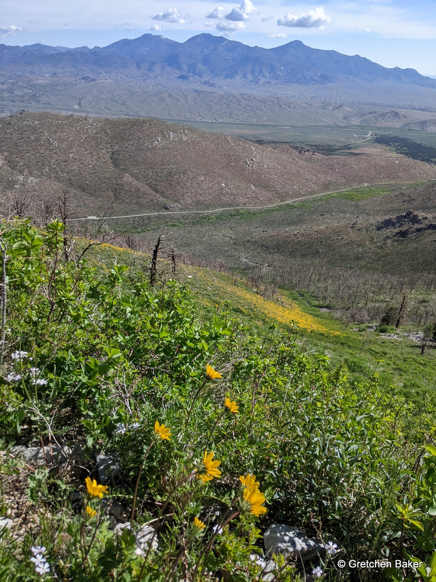
About a mile from Mill Creek, yellow flowers start appearing, Arrowleaf Balsamroot.
Before long, they are everywhere! They seem to have proliferated in the burned area.
They cover the trail, too!
Then it's time to round the corner and head into Strawberry Creek watershed. The snow-capped Schell Creek mountains are in the distance.
It's a stark difference rounding the mountain. The balsamroot disappears. There are lots of penstemon and some lupine, but they haven't bloomed yet.
It's easy to see the Strawberry Creek road at the bottom of the drainage and the North Snake Range to the north.
There are splashes of color on more-easterly facing slopes.
This distinctive-looking tree still stands.
Parts of the trail are very rocky. There's not much shade, so going early in the morning or later in the evening may be more comfortable.
And although at times the landscape can seem monochromatic, there are pops of color here and there.
As I looked across the canyon, I saw the rocky area next to the creek where some marmots live. When you're down there it seems really big, but from this perspective, it's quite small.
We kept walking and came to a big obstacle--a huge gully! Apparently it washed out in 2021 in a flash flood.
We had to find a way to get across, which involved scrambling on some steep banks.
Then we realized there was a second gully, and no good way to go straight across, so we went down to where the two gullies met.
From there we could scramble out of the massive gully.
Here's a view upstream.
After getting across, we had a steep bushwhack to get back up on the trail.
Here's a view of the second gully after we had gotten back on the trail.
We continued along, finding the trail a little overgrown with chokecherry, grasses, and forbs.
Then we came to another huge obstacle, a big rockslide ahead of us. I was fascinated by how high above the trail level the rocks were.
The rocky area was massive.
This spot was fortunately easier to cross and even had a mini-waterfall! It was here we saw a flash of color and spotted a Lewis's Woodpecker! What a treat!
As we continued on the trail, I turned around and saw where the rocks had come from, higher up in the burned area where there's still snow.
The trail is super fun at this point, curving with the mountains, and changing vegetation as the aspect changes. It's sunny and green and then you turn and it's back to mountain mahogany.
We also found more little streams to cross.
We still had one big obstacle, a huge snowpatch that always lingers.
I had my husband go first so I could get a photo with scale. It was certainly larger than either one of us remembered! It even featured a little bit of watermelon snow, or pink algae on the snow. They say don't eat yellow snow. Don't eat pink snow either!
Soon after the snow we took the cut-off trail to the Strawberry Creek trailhead. The trail had recently been worked on and was lovely.
Although most of the area burned, an aspen still lives by the trail.
This is a gorgeous hike, although one should be prepared for the washouts, as they certainly make for an extra challenge. I had worn water sandals expecting that the trail was going to be very wet. It was only really wet at the beginning on the access trail, the wet spots along the ditch had dried up, and the creek crossings can be done without much difficulty. So boots are definitely the better footwear choice.
We took a selfie at the trailhead.
And I can't end this post without showing what's just up the sage steppe trail: a field of arrowleaf balsamroot!