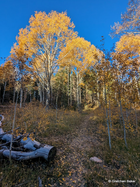
I had a day off and a beautiful forecast, so I decided to go for a long hike. Out of several options, I chose the Dead Lake-Johnson Lake-Snake Divide Trail. Part of the reason I decided on this is I reread my blog post
from October 2018, where I did almost the same route in 5.5 hours. I wasn't planning on trail running, as my body doesn't like running any more, plus I had recommended to take 8-9 hours to enjoy the sights more. That sounded good to me.
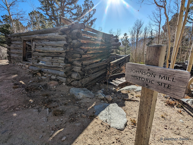
The building was renovated a few years ago using traditional methods, and still looks good.
Those miners were tough living in such a remote spot!
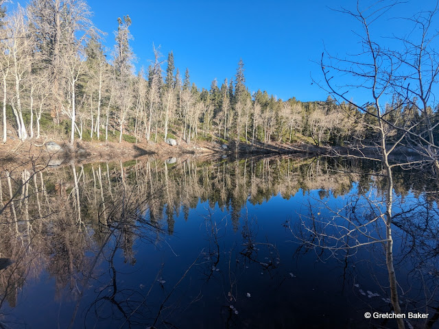
It was cold enough I wasn't tempted to swim in Johnson Lake, so I climbed up above and got a photo while taking another break to enjoy the views. I was really liking the plan of taking more breaks!
I heard some voices and saw some hikers coming down the trail.
Since I was taking the scenic route on this trip, I went on the old trail up to the mine site. There's still a cable connected that goes from near the mine down to the lake.
The mine is mostly collapsed and not very exciting.
The view from it is gorgeous.
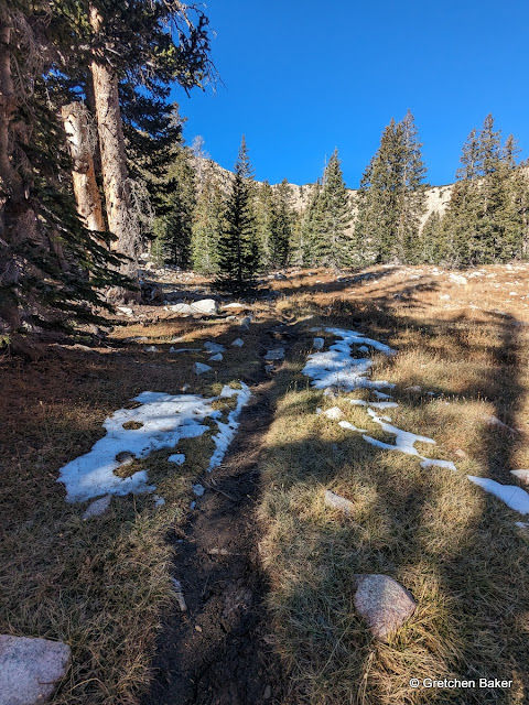
Then I scampered up to the ridge, where I found larger patches of snow on the east-facing slopes. In the background, Pyramid Peak rises up from Johnson Lake, and beyond the ridge is the backside of Wheeler Peak and Doso Doyabi.
Walking the ridge is sometimes easy and sometimes boulder hopping or tree dodging. It's not particularly hard, but it's definitely not as easy as a trail. Below is a panoramic view of looking east, down the Snake Creek drainage towards Snake Valley.
Here's a panoramic view of the west-side view, looking down Williams Canyon towards Spring Valley and the Egan mountains.
There's a very obvious trail along the ridge. I've taken it before and wanted to take it again.
It leads to an abandoned mine, where some of the trusses have fallen and some are just barely holding the boulders in place.
Back on the ridge, I checked out the middle fork of Snake Creek.
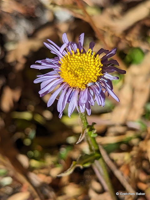
I found some
Erigeron leiomerus-alpine daisy blooming. Yay!
Along some of the ridge are trees, and you can definitely see the dominant wind pattern.
To my huge surprise, it was such a warm day that I stripped down to my tank top. I couldn't believe how warm it was for mid-October.
As I continued south on the ridge, I kept getting closer to Mt. Washington, with quite a bit of snow on it's north-facing side.
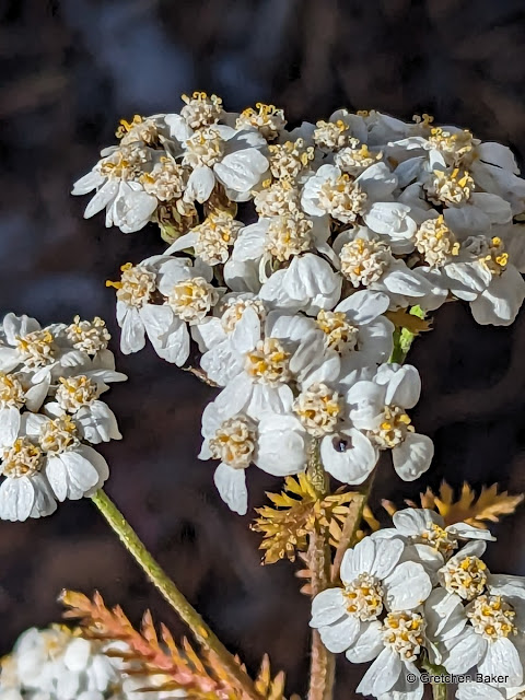
Another break for more flowers! A little potentilla (buttercup) nestled next to a rock.
And some
Phlox pulvinata, alpine phlox.
And one more, maybe a draba? With colorful lichen next to it.
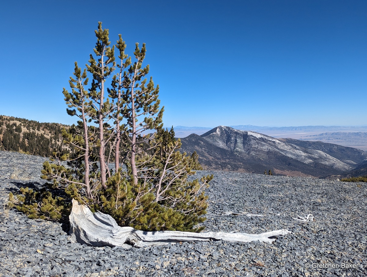
Here's a view looking northeast. The old piece of wood is far from current trees, indicating that it's probably a remnant from when trees grew up higher during the last warm period, the
Altithermal. In the background is Pyramid Peak on the left and Eagle Peak on the right.
Johnson Lake is between Prospect Mountain Quartzite (on the north Pyramid Peak side) and granite/quartz monzonite on the west and south sides. Along the ridge, I was on granite for quite awhile, then transitioned to quartzite. Mt. Washington is limestone. So it's fun to see the rocks change. And then I saw what looks like a rock with fossils!
And another one!
National Fossil Day was October 11th. I celebrated then and I celebrated again!
The changes in rock types also make for fun color changes.
And then I was rounding the corner in front of Mt. Washington and entering what's been nicknamed "The Magic Grove." It's an apt name, with some wonderful bristlecones there.
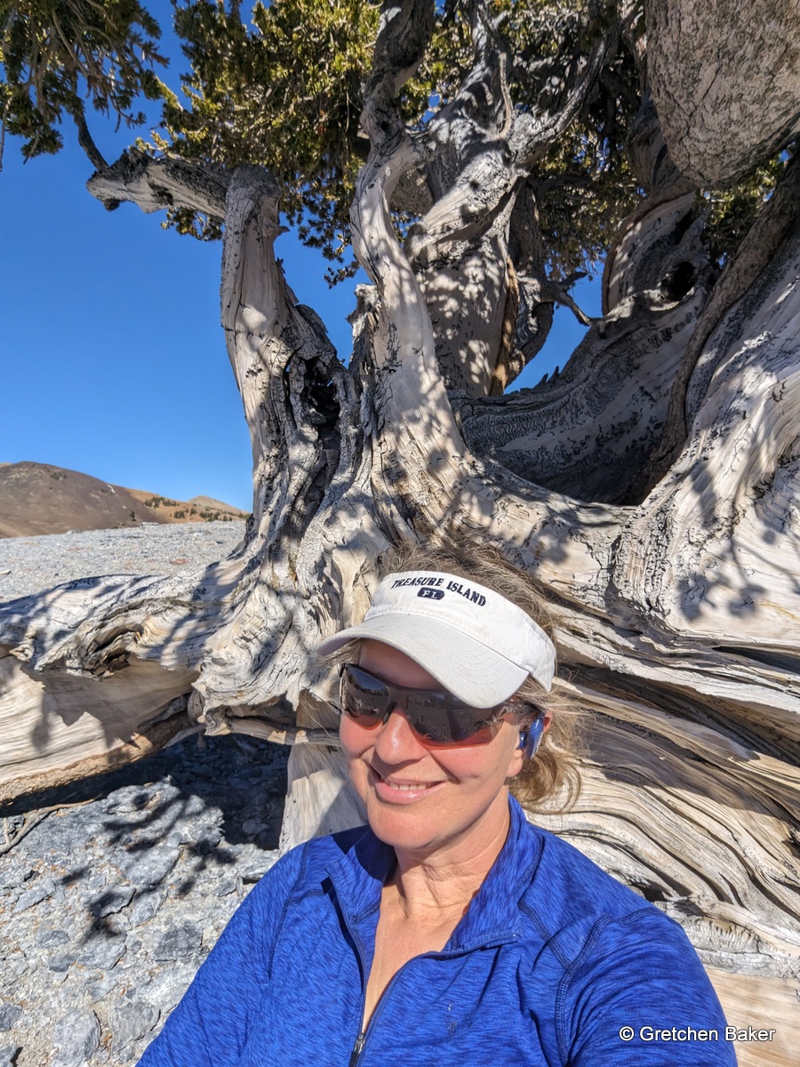
I had been trying to ignore my hunger pains so I could get to the "Quarter Tree," the bristlecone pine featured on the Great Basin National Park quarter, for lunch. Despite mid-day light and no clouds, it still looked amazing.
I did a full walk around it. Then I sat down and ate, feeling like the tree was giving me a hug. It was wonderful.
I felt in such awe of being next to a tree that's at least 1,400 years old. It's been through so many storms, so many eclipses (each spot sees a total eclipse roughly every 375 years), so many droughts, so much of everything!
Here's my blissful spot.
Then I took some time to wander through the grove. Here's a bristlecone that's fallen over, so we're looking at the twisted root structure. These bristlecone roots do not go deep.
Bristlecone wood framing Mt. Washington.
There's another tree up in the grove I feel a close connection to, and I just had to touch the wood. I was a little surprised by how warm it was.
More cool twisted wood.
This tree is about 2,400 years old.
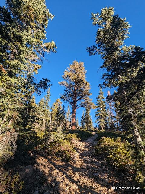
Then it was time for the long way down.
The trail kind of disappears in places, but as long as you stay on the ridge, you're okay. There's some old flagging that shows the way in places, but I imagine that will eventually fall off. The Snake Divide Trail is much more of a route at this time than an actual trail.
I found another old mine next to the trail. It looks like it might go aways, but there was no way I was going to investigate as it looked ready to cave in.
As I went lower, the bristlecone pine trees continued, but they looked different. They were much taller and had more branches. They still look like Dr. Seuss trees, though.
I took a side trip on one of the limestone knobs to see the trees on the south side. They aren't very large, but they are fun.
I also had a great view of the fall colors in Big Wash.
The lower I went, the better the trail became. There are some cool sights.
And then I came out on the Shoshone Trail.
It cracks me up that this old sign is still in place.
A caterpillar on the trail caught my eye.
The trail crew had been working on the trail recently, and it was in excellent condition.
One of the very few colorful leaves.
And then I crossed over the south fork of Snake Creek and was almost back to the trailhead.
Some rabbitbrush (I think) still blooming.
A last bit of color. And then I was back, in 8 hours and 19 minutes.
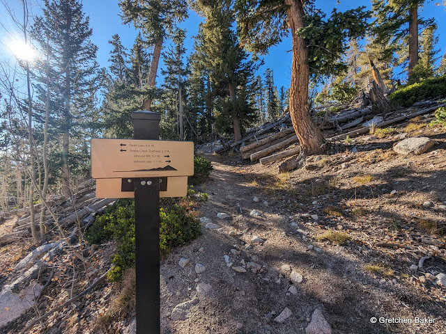
Below is a map of the approximate route I did, which Google Maps says was 10.4 miles. And here are my times in hours:minutes, so you can figure out how long of a day to expect. I walked fast at times, but took lots of breaks!
0:00 Start hike
1:01 Dead Lake
1:36 Mill site
2:18 Johnson Lake
3:26 on ridge
5:20 Magic Grove arrival
5:59 departing Magic Grove
7:45 junction with Shoshone trail
8:19 back at trailhead
It was a great day to recharge my batteries!