Showing posts with label desert. Show all posts

Wednesday, November 30, 2022

Desert Experimental Range, Utah


We had the chance to go on a tour of the Desert Experimental Range in the West Desert of Utah recently. This is one of many experimental areas run by the US Forest Service. Most are experimental forests, but a couple are experimental ranges. This one was designated in 1933 by President Hoover, and the CCC helped build it, including the impressive entrance.

Although we were early for the tour, others were already there when we arrived. We joined the group, led by Stan Kitchen, retired USFS research scientist who had managed the Desert Experimental Range for decades.


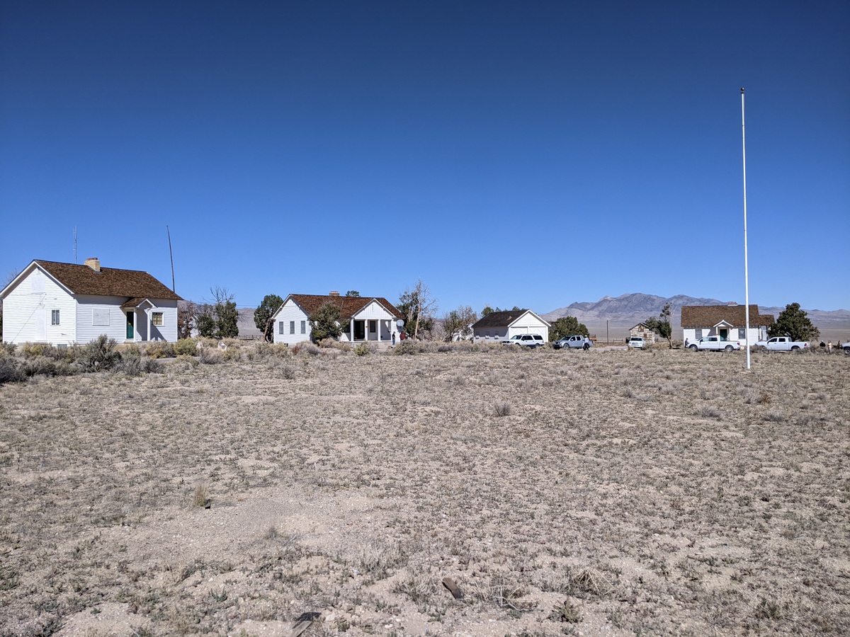
Because the Desert Experimental Range is so remote, it has numerous buildings so people can stay there. We went into the dorm, while the north house and south house are also still kept up for visitors. Because of their age, the buildings are part of the National Register of Historic Places. 

We were allowed to go into some of the buildings. There are two houses and a dormitory that are still used regularly.

Here's the interior of the dorm.

Outside of the dorm.

There's even an old tennis court!

The South House has some trees of varying health around it.

Interior of the south house.

I thought this old light fixture was cool.

There are some interpretive signs giving additional information.


I think this is the old Ice House.

The utility section is located a short distance away.

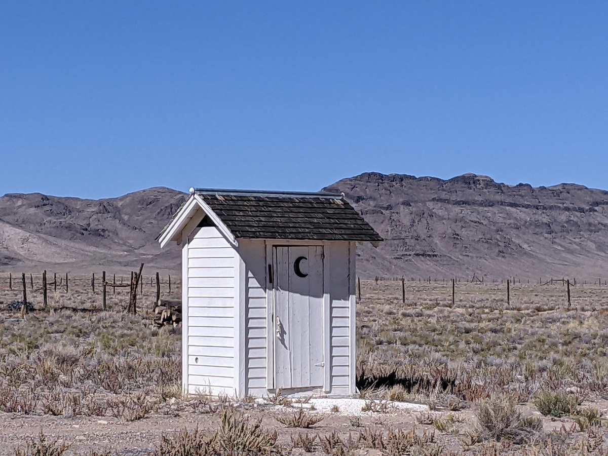
Although the houses have modern plumbing, there's a scenic outhouse on the premises.

There are also barns and trailers. They didn't look like they've been used lately.

The Desert Experimental Range has been designated as a United Nations Biosphere Reserve.

Another view of the housing area.

Then we toured part of the range, where fences have allowed various treatments over the decades. Most of the studies have focused on various cattle and sheep grazing regimes and how they impact the vegetation.

Although this trip was in October, we found some flowers blooming, like this globemallow.

Stan pointed out the "silver dollars," circles where gophers have eaten vegetation and in good conditions winterfat grows hardily. In many circles throughout the region, cheatgrass has taken over. I was delighted and baffled to find some harvest ant circles nearby. I'd love to know more about what determines which is predominant.

On the driving tour there are also interpretive signs.

Some robust globemallow! The group is talking on the other side of the fence.

One of the biggest issues is the halogeton invasion of winterfat shrublands. Halogeton is poisonous to livestock. Winterfat is very nutritious. But it appears halogeton often outcompetes winterfat, and no one knows how to reverse that trend.

Some of the beautiful winterfat, also known as white sage.

You can find out lots more about the Desert Experimental Range at: Desert Experimental Range | Rocky Mountain Research Station (usda.gov)

Monday, April 5, 2021

Spring Break in Death Valley National Park

The kids wanted to go somewhere warm for spring break, so we decided to head to Death Valley. I had taken them to Death Valley eight years ago, but they didn't really remember it. Maybe this time they will! We took off from Beatty and headed to Titus Canyon and got out a couple bikes so we could take turns riding down the fun canyon.

We had managed to reserve a site at Furnace Creek Campground for one night (spots are scarce!), and got in some sleep despite a massive wind storm that night. The next morning we headed off early to the lowest elevation spot in the western hemisphere, at Badwater Basin. Desert Girl tried to hold her breath at -282 feet below sea level. The mountains are a little hazy because of all the dust in the air.

Flashback: here they are eight years ago! 

Desert Boy liked Devil's Golf Course with the interesting salt formations.

We found an interesting arachnid in a canyon. Maybe a solfugid?

We explored an unnamed side canyon so we skipped Golden Canyon, which had a full parking lot and cars spilling out onto the highway. We continued north to Harmony Borax Works, where we learned about how borax was extracted and concentrated. It was quite interesting. I can't imagine the work, it sounded quite awful, with boiling cauldrons and terribly long transports.

Spring is a good time to visit Salt Creek to see the mating pupfish. The species that lives in this spring is endemic (only found) in Death Valley. We saw hundreds, maybe thousands, of them. In a couple months, the water will dry up near the boardwalk. Hopefully some of the pupfish we saw will make it closer to the headwaters to survive.

I enjoyed this exhibit about what the area would have looked like during Pleistocene times.

I had wanted to see Scotty's Castle area, as I worked there 24 years ago. I knew that it was closed due to flooding, but I didn't know that the road to it was closed three miles down, including closed to foot and bike traffic. Instead we went over to Ubehebe Crater. When I worked at the park, that was a five-minute stop for most people. We found a full parking lot and lots of people picnicking and hiking. 

The kids and I went around the crater, about 1.5 miles hike. We saw lots of people. And some googly eyes.

Little Hebe Crater was cool. Beyond it we could see the backcountry road we would soon be embarking on.

It led us to teakettle junction, which sports a plethora of teakettles.

Maybe because of the little sign in the corner: Take nothing but pictures, leave nothing but teakettles.

From there we headed to the Racetrack. I couldn't remember exactly where the moving rocks were on the dry lakebed, so we wandered a bit. We found this cool lizard.

And eventually we found rocks and trails. So cool!

We investigated a few.

Then it was on to our backcountry camp, the Homestake Dry Camp. I was surprised by how many people were there, 11 groups at the camp itself, plus another 1/4 mile down and another 1/4 mile up from the camp. 

We were higher elevation, so it was cold, in contrast to the balmy night at Furnace Creek. The next morning we got up and explored the nearby mine. The kids showed their dance moves on a big slab of concrete we found. (Wow, pouring concrete that far out!)

We had fun checking out an old car.

This mine (Lippincott?) was quite well preserved.

Some idiots had cut through the protective netting and descended into the adits. I love caves, but know that exploring mines is much more dangerous. I like the mantra, Stay out, Stay alive. We found very crumbly rock near the entrances of the mines, and some had multiple rocks on the floor, so we stayed out.

A horizontal adit had also been breached. Sure, those tracks look inviting, but we stayed out.

Next came a road I had never been on, the Lippincott Road. It wasn't on the park newspaper map, but I knew it existed. There was a sign at the beginning warning that 4x4 high clearance was needed, no tow service, and use caution.

I wanted to do it on my bike and found a few sections so steep and rocky that I walked the bike. 

The road didn't look too bad from a distance.

But up close there were some really rocky parts that took full concentration. My husband did very well.

I found an old "Entering Death Valley National Monument" sign. The park boundaries were expanded when it became a national park in 1994. 

We weren't the only ones on the road. Four vehicles followed us at a distance. We passed one guy who was "just out exploring" and wondered what road this was and what it was like. He planned to go uphill in his 4WD pickup. Going downhill is enough adventure for me (and enough bumpiness). 

When we exited the canyon we were in Saline Valley. To the north are clothing optional hot springs. We headed south to get to pavement, which didn't look that far on the map, but took over two hours. We passed many more vehicles. That was the thing that has changed the most since I worked there--Death Valley is so popular now, even the remote backcountry places. It's gorgeous, but you really have to be prepared to go into the backcountry. We saw one vehicle changing a flat tire but fortunately avoided any ourselves. 

We headed to Stovepipe Wells and secured a tent camping site on the edge of the 195-site parking lot (the tent sites on the edge get a bit of sand). Across the road you can get a pool pass for $5/person, which we happily did, as it was over 80 degrees. A bit later we went up in Mosaic Canyon, ordered a take-out meal (no dining in permitted), and wandered into the sand near our campsite.

After another beautiful night (the night skies are amazing in Death Valley), we woke up to clouds with a bit of sunshine. It has been so dry that we only saw a handful of flowering plants. This was quite a change from my visit for 2016's Superbloom. Fortunately, one of our favorite Mojave Desert plants, desert creosote, was blooming.

It happened to be April 1 when we were in Death Valley. An owl magically found its way to us and dropped off Desert Girl's acceptance letter to Hogwarts. She was not amused. 

Our last stop before heading home was the sand dunes. The big parking lot is another change, and much safer than when people just parked along the side of the road.

We found some dunes that were tall enough for good rolling.
By 9 am, it was getting quite warm. If you visit much later than that, you probably will have to wear shoes. We really liked going barefoot!

It was a lovely trip, and we were grateful that everything went smoothly. Our only hiccup was a delay when tow trucks pulled up a Fed Ex trailer from the side of the road. 

Death Valley National Park is a great spot to visit in fall, winter, and spring. Do plan where you're going to stay at night, as it is getting very popular, and that may influence your itinerary.
Related Posts Plugin for WordPress, Blogger...

blogger templates