Tuesday, April 29, 2014

Climbing Crystal Peak in Millard County, Utah --with Kids!

 We concluded our Volcano Weekend (Sunstone Knoll, Pahvant Butte) with a trip to Crystal Peak. In the late afternoon when the sun is out, the mountain sparkles, looking so impressive rising from western Millard County, south of Highway 6 & 50.

 The peak is remote, but since it was Easter weekend, we were expecting to share it with others. To our surprise, no one was parked at the camping areas near the road that goes by the peak.

Our goal was to climb the peak. Many years ago, my husband and I climbed it via the north face (photo above), and it was a terrifying climb. I tried another time in 2009. We knew the best way was to circle around to the south side and approach up the southwest side. Because Desert Girl had done so much hiking the previous day and my husband wants to get in shape for our Mt. Rainier trip in September, she got a free ride in the backpack.

Crystal Peak is made of Tunnel Springs Tuff, a volcanic rock that has a high quartz content in it. The rock is very white, and our eyes adjusted to the stark scenery. But then we saws burst of color.

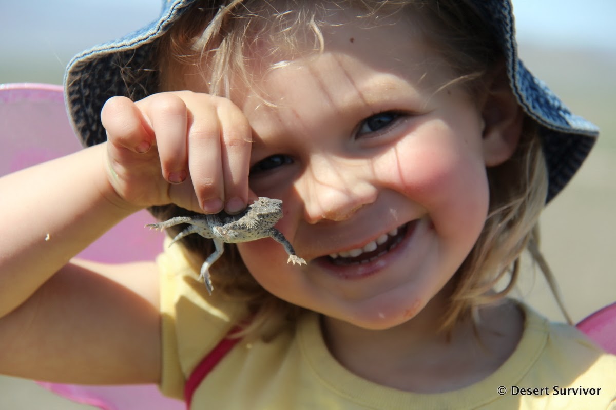
Are you ready for it?

The Indian paintbrush was spectacular!

Our dog Henry was with us for the hike, and he followed my husband and Desert Girl on the rock, while Desert Boy and I followed the wash.

Suddenly, as I was walking along, I heard a rattle. I stopped immediately and found a rattlesnake a few feet away. I backed up, got my camera out, and took some photos. Desert Boy, who had a great opportunity to hang out with a friend herpetologist a week or so ago to go find rattlesnakes, sternly told me not to get any closer to it, not even for a photo. Smart boy.

We found our way around it and then started seeing more fossils in the Kanosh shale, a highly fossiliferous layer that is also present at nearby Fossil Mountain. I believe the fossil below is a cephalopod.

Soon we reached the ridge where the Tunnel Springs tuff met the Kanosh shale. This meant it was time for the serious climbing. But first I had to admire some of the openings in the tuff, called tafoni. Sometime when we have time to just play around, we could have a lot of fun photo opportunities!

The views were just lovely, with nary a sign of civilization. Crystal Peak is quite remote! (Oh, did I mention that already!?) We did see two vehicles the whole time we were out there, so it was actually a high traffic day.

Unfortunately our climb wasn't all peaceful and serene. Desert Girl wasn't feeling her best and complained loudly. It didn't help that the way we thought was the easiest wasn't and we had to do some backtracking down sections when it got too steep for us. This is not an easy mountain to climb.

We eventually reached a section that was too steep for Desert Girl, so she stayed with Dad and took a much-needed nap while Desert Boy and I scampered to the top. Desert Boy was so pleased that he had made it! Behind him, about 40 miles away, we could see the snow-covered peaks of the southern Snake Range, including Wheeler Peak in Great Basin National Park.


To the northwest we saw various knolls and roads across the Ferguson Desert. It wasn't so long ago (at least geologically speaking) that this was all covered with the waters of the massive Lake Bonneville.

On the way back down we found an easier way to the summit and also an easier way down to the Kanosh shale hillside. Some cairns mark the way, but they aren't always easy to spot. This Google Earth image shows the way we recommend to go up (and how we came down). It was about 1.25 miles one-way.

 We probably won't be making a yearly pilgrimage to Crystal Peak, but we'll be back!
For even more information about Crystal Peak and the surrounding area, check out my book Great Basin National Park: A Guide to the Park and Surrounding Area!

Saturday, April 26, 2014

Climbing Pahvant Butte, the Volcano South of Delta, Utah--with Kids!

 Continuing on our Volcano-themed Weekend, after we finished with Sunstone Knoll and Clear Lake, we headed toward the big volcano. That's when I realized I didn't have much of a plan for what would happen next. I had read that the volcano was hikeable, but I didn't know where to start. So we headed down the marked road and eventually saw a track up the Lake Bonneville shoreline. We headed towards that track, but when we got to it, it was too steep for the truck. However, there was another track that entered the canyon.

What an adventure! The track twisted and turned up the narrow ravine, and the cinders were like driving in deep sand. I knew if I stopped, we'd be stuck, so I kept my foot on the gas and we kept going. Fortunately no one was coming the other direction. Then we popped up into the middle of the volcanic crater. (The white line in the image below is the driving line, the red line is the hiking route.)

The inside of the crater surprised me. I was expecting to see lots of black lava, but instead we saw lots of orangish rock. This orangish rock is a tuff, a combination of basaltic lava the size of sand and gravel.

One of the things that is so cool about this volcano is that it started erupting underwater about 15,500 years ago, when the Pleistocene Lake Bonneville covered the area. As the volcano erupted, it grew taller, eventually emerging from the lake. The parts of the volcano that were under the lake still have the black lava, and the lake interactions made a cool formation on the northwest side called the Lace Curtains (which we didn't have time to see this trip). For more about the geology, check out this Utah Geological Survey page.

We got our gear and started our hiking trip. Our basic plan was to walk around the top of the volcano. It didn't look too bad from the bottom, but as we started up the steep slope to the south summit, I started having doubts of how far we could go.

We could see the pillars up on the south summit, remnants of a 1923 windmill project. Some say that it was a scam, as it was never finished and the project was rather odd, with no power lines in the area. Others say it was an early renewable energy project, which put Millard County ahead of the times. Overall, there doesn't seem to be much documentation about it. The old structures make for a rather odd  but intriguing sight.

They also make for a well-visited site. We found 8 OHVs on the top of the south summit. They had taken a road up the east side.

After a long snack break, we continued towards the main summit, following an easy ridge. We took a little detour to find a geocache.

Indian paintbrush,  phlox, and more were blooming, adding some extra color to the hike. I was delighted to see the hummingbird moth near the cryptantha.

As we got higher, we faced some interesting obstacles, where the volcano rim had weathered away, leaving steep cliffs. We had to do some backtracking to find a way, but we eventually did. Here and there you can find a bit of a social trail, but overall this volcano is pretty wild and untracked.

We kept seeing different groups of OHVs arrive at the south summit (lots of people were camped in the area for the holiday weekend), but no one else was hiking. The kids were doing an excellent job. It probably helped that I told them that the reward for not whining was going to the Delta swimming pool later that afternoon.

Soon we saw the triangular metal structure at the summit get larger and larger. We were almost there! The summit is at 5,751 feet.

A rock wren greeted us. We took a long time trying to find a geocache without success.

The views were outstanding, looking out at the Sevier Desert. I was a bit surprised when I saw there was no road directly to Delta. I think the old lakebed will bog down vehicles, and it looks like the Sevier River still flows through that area. We had a good view of Clear Lake to the southwest and the Pahvant Range and Tushar Mountains to the east.

Desert Girl hiked the whole way by herself. (She knew she had to, which is a big motivator.)

After rehydrating and eating and enjoying the view, we started heading around the rim. I was a little more nervous about this part, because I wasn't sure if we'd reach some difficult obstacles. We had one part that was a little steeper than I like, but the kids are good rock climbers and managed fine. We found that it was a lot easier to descend, especially when we reached a section with cinders that made going down feel like running down a sand dune.

I estimate we hiked about 2.5 miles, taking about three hours. It was really cool to be on the top of a volcano, and now every time we go to Delta, we will have a special appreciation of that volcano to the south. And the kids got to go swimming, which was the best part of the trip for them.

Pahvant Butte from Highway 6 & 50 west of Delta.

Wednesday, April 23, 2014

Sunstone Knoll and Clear Lake, near Delta, Utah

This last weekend we decided to have a volcanic theme and visit several volcanic areas. First up was Sunstone Knoll, about 13 miles south on Highway 257 from Delta (near mile marker 56). A BLM sign helpfully points out the turnoff. Right after the turnoff you cross the railroad tracks, and we noticed a train was coming. The kids were delighted.

After watching the train go by, we parked next to several other vehicles. An extended family was out for a morning of fun. Sunstones are a slightly yellow, nearly transparent semi-precious gem. They were extruded from volcanic vents and are found with the basaltic lava and volcanic breccia. If the sun is shining, it is easy to find these labradorite crystals, as they sparkle in the sunlight. They are generally quite small, but they can be abundant and it is like a treasure hunt to find them.


We were also on another treasure hunt: to find the geocache at Sunstone Knoll. We had success, and the kids are getting better about really watching their surroundings.

I got distracted by this pretty hemiptera, a true bug. I liked the reddish markings.

Of course, Desert Girl was hiking in style. I made her wear her new hiking boots and pants, but she figured out a way to liven up her outfit.

We were all entranced by a horned lizard.

The kids followed it to a bush and then decided they had to catch it. I wasn't so sure they could...

…but they did!

After Desert Boy's inspection (he now wants to be a zookeeper when he grows up, but he doesn't want to clean the animal pens), it was time for the handoff.

Desert Girl was happy to hold the lizard. She later caught one all on her own.

Then it was time to leave Sunstone Knoll and its interesting geology and head to nearby Clear Lake Waterfowl Management Area (go 1.5 mile further south on Highway 257, then 6 miles east on the signed road). This area consists of 6,190 acres of open water, wetlands, and uplands. It was purchased in the 1930s primarily to provide bird habitat. In February and March, it hosts thousands of snow geese. During spring and fall, it is an important migratory stop. Clear Lake is pretty primitive, with no facilities.
 The first sign we saw was next to a dried out area, so it didn't look too promising. Fortunately down the road we found some water.

We did see our next destination, Pahvant Butte, the prominent volcano south of Delta. Our big plan for the day was to hike it, so we didn't spend much time at Clear Lake.

But there is a geocache hidden at Clear Lake, so we went in search of it and found some additional wet areas.

On the way, we found this awesome truck.
 "Clear Lake-Greatest Wetland in the World"

Tuesday, April 22, 2014

An Egg-citing Experiment

 I went over to Desert Boy's school the other day and we talked about how birds make different kinds of nests. The kids made their own nests, which varied from a hole in the ground to some grass on branches, to a big platform of sticks. Then we had time to talk about what goes in the nests--the eggs. I had the kids inspect the shape of the egg, and we talked about how arches are one of the strongest shapes and how an egg incorporates arches. To make sure they remembered that eggs are strong, I then had them stand on a fresh eggs. They didn't want to do it at first, but they were all quite excited once they saw it worked.

 Every kid in the class stood on the eggs, and none of them broke, much to their amazement.

We had one more science experiment: try to crack a raw egg by squeezing it as hard as you can with one had.
 We actually did have one egg break open (good thing we were outside!). I think it probably had tiny cracks in it before we started. Or maybe Ava really is the strongest one in the school!

So if you have extra eggs lying around, give it a try! There's a tiny bit of fear as you wonder if you will have a big mess to clean up, but most likely you won't.

Happy Earth Day!
Related Posts Plugin for WordPress, Blogger...

blogger templates