Thursday, December 31, 2020

So Long, 2020!

2020 will be a year people talk about for a long time. 

I like to focus on the positive, so here are some highlights from the year, in no particular order:

  • Comet NEOWISE was the first visible comet to the naked eye in quite awhile. I loved trying to find the best places to photograph it.
  • We broke our previous record for our Backyard Bird Count (set in 2019 with 45 species) with 47 species for 2020 (see sidebar).
  • I read a lot of books and listened to more. I'm starting to keep better track because I get most from Overdrive (the free app that lets you check books out of your library.) One that I listened to and then had to buy was Dare to Lead by Brene Brown, which is chock full of great advice on how to be a good leader (care about people, don't avoid the hard conversations, and communicate clearly are three main takeaways). 
  • Our family stayed relatively healthy.
  • I joined Toastmasters in October and have really enjoyed the weekly meetings to improve public speaking skills and leadership as well as listening and evaluation skills.
  • I got to do a fair bit of caving despite the pandemic, visiting caves in Nevada, Wyoming, and Arizona. This included finding some new caves and mapping them with the kids, teaching cave rescue, plus learning so much more about cave geology, cave LiDAR, and more.
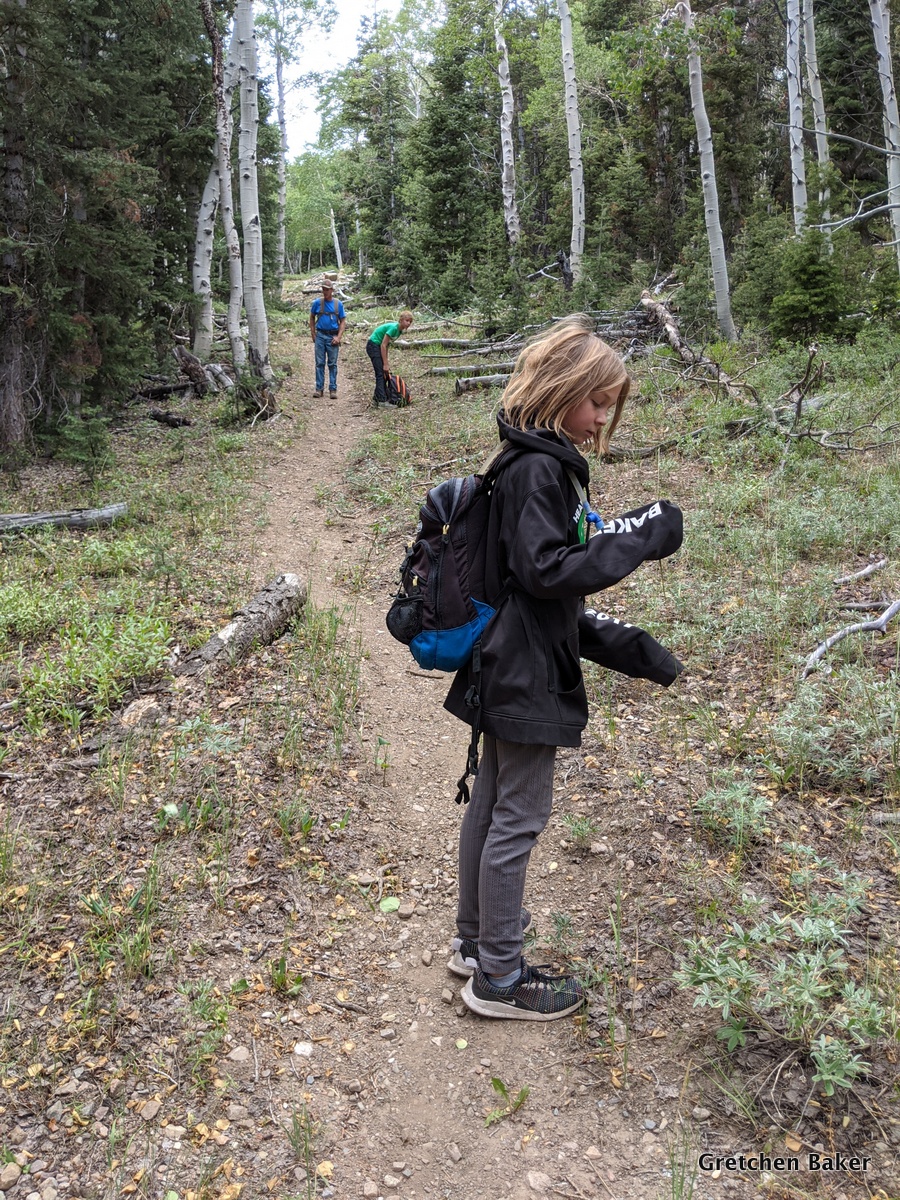
  • We explored a bunch of our "big backyard." I especially enjoyed trips to the Fortification Range and the North Snake Range in Nevada. 
  • We decluttered the house a little more. 
  • Work was very productive for me this year, with lots of projects that could be done from home or out in the field. I particularly enjoyed helping with the inventory of Lehman Caves, lint camps, breeding bird and Christmas bird surveys, writing grant proposals, LiDAR of the Lehman Caves tour route, and learning more about the only glacier in Nevada.
  • Our local trails projects have gotten off the ground, with funding secured and progress happening (although slower than I wanted, there is some light at the end of the tunnel).
  • The kids have learned some new skills. Desert Girl has really improved her sewing with the help of a couple wonderful local women. Desert Boy has taken up forging and with the help of his cousin got his 3D printer working.

  •  Desert Girl has really bloomed with daily horse chores and weekly horse riding lessons.
  • The kids had a (mostly) successful 4-H year. (Desert Girl had issues with her sheep and wasn't able to show in the fair, but everything else went well, and she was delighted to get to show a goat in the round robin competition.)
  • My Aunt Pat passed away, and I have fond memories of her from various family gatherings. 
  • Ice skating was lots of fun.
  • We watched the kids grow amazing amounts this year and get better than me at things like cross-country and downhill skiing, running (Desert Boy beat me at Thanksgiving in a family 5k), and short hikes. 

I hope you've been able to find some bright spots in 2020. How we deal with our lives when they don't exactly follow the path we we thought we were taking tells us so much about ourselves. Here's hoping we can learn and have an even better 2021! Happy New Year!

Saturday, December 26, 2020

Sacramento Pass 5K - Weaver Creek Trail

I've had a sore knee, so I've been walking more than running lately, and during Christmas break I wanted a longer walk. I also wanted to be away from the highway (near where I live, many of the loops I do include a highway section, and the dogs make me uneasy near the highway) and not in much snow. So what better place than the Sacramento Pass Recreational Area trails? 

I've done a post of the lovely 7-mile Sac Pass loop. And that's what I was originally intending to do. But then I didn't have as much time as I needed and somehow ended up on a dirt road heading up the country. I was surprised to see this trail marker, mile 1 for the Weaver Creek trail.

Upon arriving home, I looked it up, and found vague references to this trail, including on the BLM website and this horse-riding blog. Apparently it's a 6-mile trail that leads into Great Basin National Park (I'm guessing the Strawberry Creek area, but I couldn't tell from Google Earth). I will have to investigate sometime.

For this trip, I continued until I reached a four-way intersection along a fenceline. Apparently the Weaver Creek trail continues up hill, but I was ready to make a loop, so I turned right.

This is where it got fun. There were three ups and downs crossing small drainages.

One had a little snow, but fortunately nothing I couldn't handle!

When I got to the next intersection, I turned right. I had lovely views of the North Snake Range. I wish we had more snow up in the mountains, it's looking so very dry for the end of December.

Eventually I could see the upper part of the Sac Pass Rec Area camping (4 designated sites in the upper area, plus equestrian amenities). 

It turned out that the loop was about 3 miles or 5km. It was such a lovely 5k, and just what I needed, simple beauty and an easy-to-follow path so my mind could work on sorting itself out. I need these little explorations to both relax and rejuvenate. I'm excited that there are so many other roads in the area to explore, I have a feeling I'll be back in this area soon!
Red shows the designated Sac Pass trails, orange shows the 5k route I took. Highway 6/50 is in the upper part of the image and Weaver Creek (often dry) is the green line at the bottom part of the image.

I'm hoping you're able to enjoy some post-Christmas outside time!

Sunday, December 20, 2020

FREE! TAG: The Acronym Game

 In November I was ready for some new board games. So I ordered some. Some were good (for example, Don't Be Meme), but some weren't so good. And they were expensive. After a little thinking, our family came up with our own game, TAG: The Acronym Game.

It's fun, and we're going to share it with you free via my website. Just download the pages and print them, cut them to size, and you're set to go.

Example of some of the acronyms in TAG: The Acronym Game

The game has a simple premise. Take a known acronym (or initialism for those who want to split hairs), for example UFO for Unidentified Flying Object. Draw a theme card, for example Newspaper Headline. Now each person makes up a new acronym for that theme. UFO could now be United Forces Organize or Underwear Frees Odors. Okay, this can be hard! 

After each person goes, a vote is taken for favorite (we like to do it by counting down from 3 and then pointing at the person we choose). Whomever wins gets a point. Play to 7 points. Or 10. Or 15. The rules can be rather loose. 

After a round (4-5 cards), pick a new theme card, such as Food and Drink. Now UFO could be Ugly Fried Onions or Unbelievable Fritters and Oranges. It's a game that won't repeat itself for a long time. 

You might be asking why free? Because it's 2020, and everyone can use something positive in their day. And it's Christmastime, and we enjoy giving. And maybe, just maybe, we're just too lazy to try to do anything else with it.

Perhaps we'll try to come up with more games in the future. And perhaps not. But for now, go give TAG a try!

TAG: The Acronym Game

Thursday, December 10, 2020

Finding the Lost Strawberry Creek Cabin


My husband wanted to visit a hidden cabin up Strawberry Creek drainage in Great Basin National Park. He used to go to it as a teenager, when his family had grazing rights in that area and before it was a national park. The grazing rights were retired in 1999, the road to the cabin was abandoned, and now it's really hard to get to. We decided the easiest way was to climb up and over Bald Mountain and then hike down into the drainage.

There's an old weather station on the top of Bald Mountain. It doesn't work anymore, as the winds can be ferocious up there.

One of the best views of Wheeler Peak is from the top of Bald Mountain.

We decided to take a family photo with that great background.

There's a big rock pile and a stick at the summit. Fortunately it wasn't very windy, so we enjoyed a snack. We kept an eye on the clouds, which were building.

Then it was time to start hiking down. Desert Girl gave me some attitude at altitude.

There is no trail, so it can be tough going.

Desert Girl liked the deer bed, which was a little flatter.

Then she got up and continued down. In 2005 an avalanche took out a bunch of trees, leaving a very visible scar.

This photo shows how steep it was. And the building clouds.

The avalanche area is more shrubs. We stayed in the open until we got near the bottom of the steep part.

Then we headed into the woods and found an old road that my husband remembered. The track was extremely faint, and I had never seen it marked on any map.

I had to pause to get a photo of this mushroom. It really surprised me, as it was such a dry year!

We saw a lot of elk sign, like this rubbing.

We continued on, enjoying the beautiful views.


Eventually we came to a spring. My husband had remembered it and fortunately we found it.

He remembered it having a lot more water. We found this old 55-gallon drum that had been made into a water trough.

Nearby we found a sign on a tree.

It was really hard to read, but mentioned something about a Sensitive Site and US Department of Agriculture, 194?, and Forest.

Not far from there we came out on a rocky area. We could look over to Windy Canyon and beyond to Mt. Moriah.

Apparently decades ago my husband and his friends left a skull up on the rocks. It was still there.

We walked along the trees to find the cabin and didn't spot it until we were almost there.

The one-room cabin was probably built in the late 1960s by the Robison family, who had sheep grazing rights at that time.

Some extra windows were stored around the back, along with some tubing. There was a faucet outside the cabin, but it didn't work, and my husband didn't know where it would be bringing water from.

Inside there's a wood burning stove.

And a table and some bunk beds. It looked in pretty good shape, with some rodent sign, but not an overwhelming amount. With a little stabilization (mainly protecting the roof), the cabin can probably last a long time.

I spotted some elk on the opposite hillside. (They really aren't too distinguishable in this photo, but they are larger than what I saw.)

There are lots of tree carvings in the area. I was amused by the one that said "Ojo", which means "eye," right under the eye of the aspen. Palomino carved on numerous trees in the areas. I think he was a very bored sheepherder.

After a lovely exploration and rest, we decided it was time to head down. Fortunately the clouds had not developed into thunderstorms. I guess we shouldn't have been that surprised, we never really had a monsoon season during 2020.

We followed the old road as much as we could, but it was not easy going. So many trees had fallen across it that we had lots of obstacles.

Here's another section of the old road. No wonder you can't make it out on Google Earth!

After what seemed like a very long time, we came out on the Upper Strawberry Creek trail.

There were plenty more tree carvings. This one showed where the water was.

I loved the flowers!

We also saw some butterflies.

My husband remembered a 1903 arborglyph, and we eventually found it. It was nearly illegible.

We moved down a bit farther and got into the 2016 burn. Then we hiked out to the trailhead, where we had left a vehicle.

It took about eight hours for the whole trip. It wasn't super hard, but it also wasn't super easy. It was nice to have the uphill part done early in the day and then just keep heading downhill, although with all the obstacles, we certainly got a core workout. I managed to forget my Garmin watch, so I don't have a GPS track of our route. I guess that adds to the mystery of the lost cabin!
Related Posts Plugin for WordPress, Blogger...

blogger templates