
I also found an arborglyph I had previously missed. Coming down the trail it's near a stream crossing and says "Turn here or the bears will get you." I had to laugh. There are no bears in the area, but it is attention-getting.

I took less water with me and brought a water filter, so about mile 8 on the trail, I stopped at this beautiful section of creek and filled my water bottle.

Then I kept going. I stopped to admire this twisted bristlecone and eat a snack. I call this bristlecone the Dancing Bristlecone and got to visit it earlier in the year. It's one of my new favorites.

The twisted trunk was worth a closeup.

Once you get up to the Table, the trail up Mt. Moriah is almost non-existent. There is a very faint on one that starts on the northeast side.

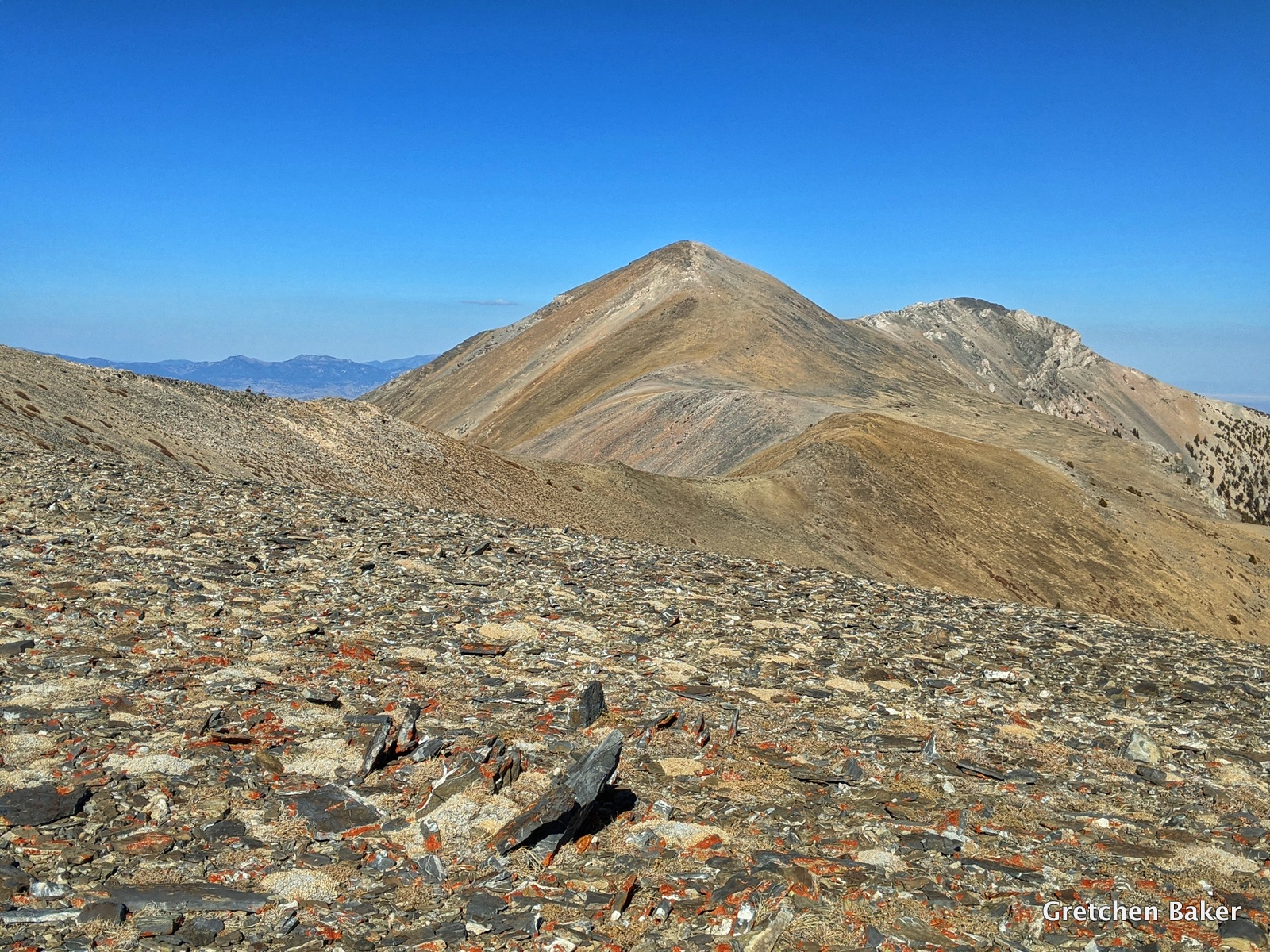
I followed it awhile and then went straight up to Mt. Moriah, which is the peak in the background. Previously we've followed the very faint trail to the southeast side of the mountain and then climbed up a gentler slope.

It was beautiful at the top, warm and calm. It was hard to believe it was early November! It took me a while to find the register, it's hidden on the outside of the stone shelter, in the rocks in the foreground.

Yes, I really made it! I had the whole place to myself.

My Plan A was to continue south along the ridge and visit more of the alpine area of Mt. Moriah, then bushwhack down a ridge to the trail. I assessed how I was feeling, what the weather was like, and the time, and decided to go for it. The ridge was beautiful, although the flowers were past blooming and there weren't any animals to be seen.

The trees near the top took twisted and bent forms.


The top was rather clear, but as I got lower I got into a lot of downed trees. Then I reached mountain mahogany and had to climb my way through a thicket. That was the hardest part. But eventually I reconnected with the trail.
As I headed down the trail, I wanted to try and find the intersection to the fork that used to lead over to Silver Creek. And I did! I saw these blazes on the trees and a very faint trail going off into the distance (with another blaze down the way). It would be so cool if this trail was cut out and connected.


 I was so glad I had finally climbed Mt. Moriah via Hendry's Creek. It was gorgeous, epic, and I want to do it again.


I was treated to a beautiful display of color when I got back down into the cottonwoods. I wasn't expecting so much color in November.

Here's the overall route I took. I got back to the truck after the sun had set. The whole adventure took covered 21.9 miles and took just over 11 hours. It was over 6,000 feet elevation gain and loss.


