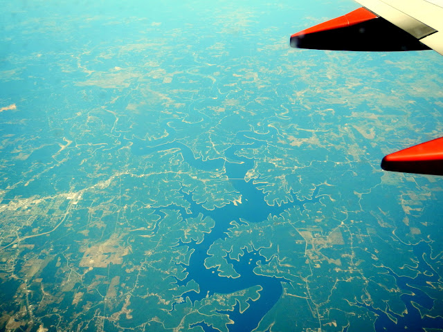
I flew to the National Cave Rescue Commission weeklong training in Mentone, Alabama via Salt Lake to Las Vegas to Nashville. I managed to score window seats on both flights and it was a clear day, so I had a lot of fun looking at the terrain. Can you identify what I saw? I'll have the answer at the bottom of each photo.
First flight: Salt Lake City to Las Vegas
Little Sahara Recreation Area, a large sand dune area north of Delta, UtahSevier River, at 383 miles, the longest river in Utah.
Sevier Lake. Usually it's Sevier Dry Lake, but at this time of year it still has water in it.
Wind farm north of Milford, Utah.
Pig farms south of Milford, Utah.
Very cool geology.
A mine with Valley of Fire in the background.
Next, on to the flight from Las Vegas to Nashville:
The Grand Canyon, Arizona.
Shiprock, New Mexico.
Oil or gas wells, New Mexico,
Most of the agriculture is no longer pivots.
Maybe the Ozark area?
On the return trip, I had a window seat on the other side of the plane. It was a lot cloudier, but over Arizona it cleared up.
Meteor Crater.
Sunset Crater, south of the Grand Canyon (well worth a stop!)
I liked how obvious the lava flow was from this crater.
More of the San Francisco Volcanic Field, an 1800-acre area with more than 600 vents. It looks so cool from the air!
Next time I hope to remember a map so I can figure out even more landmarks.


3 comments:
That's really cool. Feel like I'm looking at a 3D topo map. NICE!
Cool photos! I like to do that while flying too! (not take pictures, but look down and see if I can tell where we are and what we're looking at) :D
Cool photos. Great pic of Shiprock, New Mexico!
Post a Comment