Overview

Hendry's Creek is a long drainage on the east side of the North Snake Range. It has been home to Bonneville cutthroat trout (BCT) for millenia. Mt. Moriah tops the drainage at 12,050 feet. Several springs join to make a creek that flows over 15 miles out into Snake Valley.
The Hendry's Creek trail is amazing, over 10 miles going from 5,921 ft elevation up to 11,018 ft at the Table, a high elevation plateau. Do not attempt this trail during high water. There are 14 creek crossings plus numerous spring crossings. Peak streamflow is usually mid-May to late-June. If it is difficult to get across the first creek crossing, it will be difficult many more times. In late summer/autumn, you can do the trail without getting your feet wet (with some care). If you don't want to do all 10 miles, the first 1.5 to 2 miles gives you a good taste.
Getting There
From US Highway 6/50 (near the Border Inn on the Utah/Nevada stateline), take the Gandy Road about 9 miles north. Where the road curves, go straight to the stop sign. Then go past a big rock monument that says "Hatch Rock." Reset your odometer here.

- 0 Hatch Rock
- 2.7 Cattle guard
- 2.8 Road junction-go straight
- 2.9 Road junction, go right on the fainter road, aiming towards the canyon. You will soon see some ponderosa pines ahead in the drainage.
- 3.2 Road junction, stay left
- 3.5 Big campsite
- 3.7 Little campsite in water birch
- 3.9 Trailhead
Trail Landmarks
These mileages are from my Garmin watch, which said it was 10.3 miles up and about 10.1 miles down.

- 0 Trailhead
- 0.1 1st creek crossing, watch for poison ivy
- 0.5 Claim marker-white post with rocks around it; big ponderosa pines
- 1.0 2nd creek crossing (dry in Oct 2020)
- 1.5 3rd creek crossing (dry in Oct 2020), look for bristlecone pine on left side just after crossing, then Mt. Moriah Wilderness boundary
- 2.0 Garnets and staurolites
- 2.8 4th creek crossing
- 3.1 5th creek crossing
- 3.7 6th creek crossing
- 4.0 7th creek crossing, more aspens
- 4.2 huge ponderosa pine
- 4.5 spring across trail, lots of horsetail/scouring rush
- 4.7 8th creek crossing
- 5.2 campsite in aspens with arborglyphs, 9th creek crossing
- 5.3 10th creek crossing
- 5.7 big campsite
- 6.0 11th creek crossing, spread out, follow rock cairns
- 6.7 12th creek crossing
- 6.9 13th creek crossing
- 7.0 14th creek crossing
- 7.1 big campsite in aspens
- 7.4 canyon with creek heads left/north
- 7.6 spring brook along creek
- 8.0 Bristlecone and limber pine on either side of trail
- 8.3 View of Mt. Moriah
- 8.4 Tiny spring, last water in Oct 2020
- 8.5 Start up switchback up hillside
- 8.8 On ridge, head west again
- 10.3 Trail junction and sign (Big Canyon 006, Hampton Creek 077, and Hendry's Creek 078); You're on the Table!
- 11.3 Other (west) side of the Table and cell service (AT&T and T-Mobile)
The Details
I had the whole trailhead to myself. There was a hunter's tent and vehicle at the big campsite. I had left Baker, NV in the dark and when I arrived at the trailhead, the sun was just reaching the taller peaks.

The first stream crossing is at just 0.1 miles. It was easy to stay dry, and with drought conditions, the poison ivy wasn't noticeable at all.

The first part of the trail goes through sagebrush and rabbitbrush. About the first five miles are part of an old road, which is sometimes easily distinguishable and other times not.

About 0.5 miles in is a mining claim marker. You will see these all over the hills around here, they mark someone's mining claim. Some are still current, but many are historic.


The 2nd creek crossing was dry. During late summer, this section of the creek can dry up.

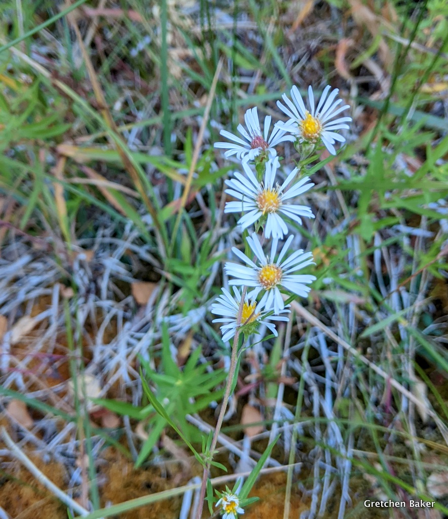
I was happy to see some asters in mid-October. Earlier in the year there are so many flowers blooming. You can see a sampling of spring flowers in this post and summer flowers in this post.
The rock surrounding the drainage is quartzite. You can find more about the geology here. The beautiful rock is quarried nearby by Mt. Moriah Stone. We have a beautiful patio made of the rock.


Just past the third creek crossing, look to the left (southwest). Do you see a tree that looks out of place? The one with the Dr. Seuss-like bottlebrush branches is a bristlecone pine. It's way below where it's supposed to grow.

Just a little bit farther, at about 1.5 miles from the trailhead, you enter Mount Moriah Wilderness.


The fall colors were beautiful, with the skunkbush vibrant red in places.


4th creek crossing--water again!

The goldenrod was going to seed.

5th creek crossing

6th creek crossing

I noticed some maple leaves. Maples aren't common around here, but there are a few if you know where to look. (Grey Cliffs in Great Basin National Park is another location.)

7th creek crossing. This is about 4 miles up trail. A few aspens appear.

Soon after this creek crossing there are a bunch of ponderosa pines.

A really large one all by itself stands out.

The lower bark is charred, but looking up at its branches, it looks vibrant.

A bit farther on is a spring area with lots of horsetail (Equisetuum sp.), also called scouring rush. It can clean out your cooking pot well.

Some fireweed that had gone to seed glowed in the sunlight.

8th creek crossing. You can see many more aspen trees now.

I liked the rock layers next to the trail.

I wondered about the root system of the ponderosa on top.

Most of the trail was clear, but there were some really big trees that had fallen over it and made for some obstacles.

The first defined campsite with a fire ring is at about mile 5.2.

9th creek crossing.

I liked how these tall aspens looked contrasted against the sky.

I missed a photo of the 10th creek crossing. The 11th creek crossing was weird, the stream was split into several channels. I saw a BCT in one of the channels on my way back down.

A burned snag with wolf lichen on it caught my attention. We don't have much shaggy lichen in this area, but this tree was covered with it.

12th stream crossing. The creek is getting a lot smaller.
Oh, the colors! I wasn't expecting them after the previous tall, almost bare aspens, so they came as a wonderful surprise.

The aspen leaves were like a colorful carpet.

13th creek crossing.

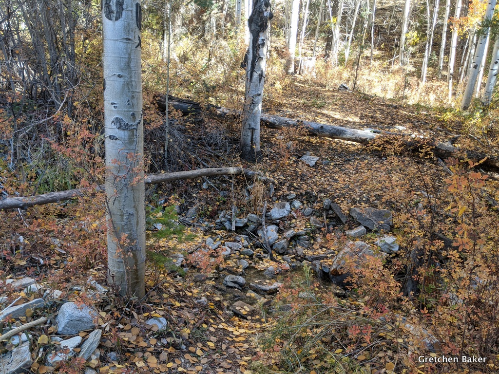
14th creek crossing. I was so confused here, because I was on the south side of the creek and knew I would be going up the north side of the drainage. In about 0.4 miles, the creek goes up a side drainage to the north.


Although the main creek went away, a little brook appeared next to the trail, sometimes dry and sometimes with water.
Just a short distance above here I met up with a hunter. He said he was on his 80th birthday celebration and had just spent two nights in the backcountry. He had a buck in his gunsight two different times, but didn't shoot because it was too far to get back, and with all the trees down would take even longer. I was so impressed with how big his pack was and how happy he was to be in the backcountry.

A bit farther ahead I had a view of Mt. Moriah! A tiny spring was the last water available at mile 8.4.

At mile 8.5, the trail made a big turn and started up the hillside. In about 0.3 miles, I reached the ridge and headed west again.

I went through a big area of recent mountain pine beetle kill. They had attacked the limber pine.

It was great seeing Mt. Moriah getting closer and closer!

At mile 10.3, I reached the trail junction on the east edge of The Table! I was really happy. I started on the Big Canyon Trail, which crosses the Table.

The east side of the Table is rather plain. This high elevation plateau is also rather flat.

Off to the northeast I could see the lakebed to the east of Gandy (Gandy Salt Marsh) and the small mountain range just beyond it, then the Confusion Range and the Fish Springs Range.

As I walked along the trail, I was in for another surprise. A bunch of bighorn sheep were grazing! They ran away from me and then started grazing again.

I couldn't resist visiting a couple of my favorite bristlecone pines.

This one I've featured in some night time photos.

I even found a rock in the shape of Nevada.

The surprises weren't over. While I was eating lunch watching the bighorn sheep, a friend appeared! He had come up from the Big Canyon side and was going to attempt Mt. Moriah. As much as I wanted to join him, I knew I still had 10+ miles to go. There's not really a trail up the mountain, but gave him some general advice based on our summit in 2014.

As I headed back down I noticed all the baby bristlecones.

As I journeyed downhill, I didn't take as many photos as the way up, but I still had to stop from time to time.

The Hendry's Creek trail is just so beautiful. I also appreciated how less rocky it is compared to the trails in the South Snake Range, which cover more previously glaciated terrain, so there are more moraines and glacial outwash features, and thus many more rocks.


I noticed different arborglyphs on the way down, some from people I knew. It took me awhile to figure out who BC was, but I eventually got it.


I've gone out on kingsnake surveys before, trying to find these elusive creatures. And here I wasn't even looking for one and managed to find one, and in mid-October. What a great way to end my hike.

Fall is such a great time to take this trail. The water is low, the aspens are gorgeous, it's not too hot, and the wildlife is amazing!

I finished my trail run/hike about 10.5 hours after I started, as the sun was getting low in the sky. I will be going back, and either I'll have to go when the days or longer or will have to get faster! :) Or backpacking is a terrific option, then you can can spend more time enjoying the great scenery and can explore even more.


5 comments:
Thanks for taking me back to the magical mountains and desert of eastern Nevada this morning, with your fine photos and commentary.
Beautiful photos! Glad you saw a snake, what a treat!
I will try again--could not find where to register. Here is my "registration:" if you want to respond to this message. I really enjoyed your "eye" for beauty and your sensitivity to nuances of energy and feeling. And, of course, all the photos! I will be 80 later this year. For the past 10 years I have spent most of the summer (extended from late Spring to early Fall) on trips of 10 to 15 days in my popup truck camper (4Wheel) on a Tundra, going to places in the West from southern Ariz and New Mexico to as far north as British Colombia. I return for about a week between trips, to Prescott AZ where I live. Since aging has reduce my enjoyment of hiking (and how much I can do), I usually explore by driving, enjoy the scenery, and have a great time. On paved roads with little traffic and also on a lot of dirt, gravel, and whatever roads. Last year--in a learning experience--I was on the worst road ever (for me) in New Mexico, and I had to have new rotors and breaks on the back wheels and a new u joint in the middle between those wheels. Now fixed and anticipating with excitement getting back to some trips before long. Thanks for your trip report.
Hiked 3.2 miles up from the trailhead today. It was hot to start but quickly became a magical wonderland in the canyon. Thank you for the guide to get there. We had such a great time!
Hi, great post! Amazing snake! I enjoyed looking through your pics. I am visiting this area at the end of September, and am hoping to do this hike (or another in the area). Do you think it would be ok to car camp at this trailhead for a night? Or can you recommend any other nearby roads for car camping for one night?
Thanks! Happy trails!
Post a Comment