
Strawberry Creek, in Great Basin National Park, closed in August 2016 when a big wildfire burned about 4,500 acres of both park- and BLM-managed land. Since then, the gate at the park boundary has been closed until May 1, 2019, when it was opened to day use. We wanted to see what had changed, so we went for a lovely visit.
At the lower elevations, there are lots of grasses and forbs growing. Unfortunately, many appear to be non-natives (cheatgrass and mustards), but there are a good number of natives in there. Plus, the vegetation has helped stabilize the soil, which means flash floods are less likely (they are still possible, so stay out during storms).

The bridge has been reinstalled. It had been taken out because it was thought that a big flood after the fire would have wiped it out. Big storms over nearby burned areas (Hampton Creek and Lexington watershed) created some massive floods. But Strawberry Creek lucked out. There were small floods, but nothing major.

We went up to the trailhead to start the Strawberry meadow loop, about 2 miles long. The first obstacle is getting across Strawberry Creek, since the foot bridge is gone. It's not too hard, and I have a feeling it will be improved in the near future.

A short ways up the trail is this sign that survived the fire. It has an illustration of the scenery pre-fire. You can see some changes post-fire.

The Nevada parsley was in full bloom!

The buttercup really decorated some hillsides.
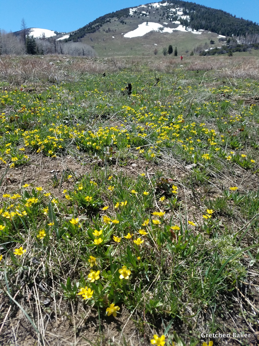
Here's a view from near the top of the meadow looking down canyon.

Then we came to another obstacle: crossing the creek again without a bridge. We added some big rocks to the streambed to make it easier for ourselves and those who follow.

Desert Girl stands near the sign at the junction. To the right, the trail goes up to the Osceola Ditch (used in the late 1800s to carry water from nearby creeks to the mining town of Osceola) and to Willard Creek. To the left is our loop.

As we hiked down, we followed some pink flagging. We also saw some places where water was running in new channels. The 170% snowpack we had this winter is creating some new streams.

here's a view of the main creek, with the tall, dead trees next to it.

Another creek crossing without a bridge! Altogether there are four creek crossings without bridges. Peak stream flow will be about mid-May to the end of June, so be extra careful then.

Then we lost the trail. We knew the general direction and kept hiking that way.

Aha, we found the trail again! Can you tell this is the trail? It looks a lot different now.

Then we reached a part where some flooding had wiped it out again. Fortunately the vegetation is all low enough that it's not hard to cross.

We found another little impromptu stream.

We're getting close back to the trailhead!

And then we were totally surprised by the last bridge being in place.

Can you tell what Desert Girl has in her hand? It's a snowball, as we found a little snow patch. She couldn't wait to throw it.

This landscape has changes so much. The Bonneville cutthroat trout in the stream have really suffered from the fire, but most of the rest of habitat will rebound and actually be healthier.

It's great to have this opportunity to go up into Strawberry Creek and see how this watershed has changed. Some interpretive signs should be installed this summer, sharing even more information about how this area is coming back.

To see more photos of what this area looked like pre-fire, check out this 2013 post.


No comments:
Post a Comment