Showing posts with label geography. Show all posts

Wednesday, May 3, 2017

Visiting Pattern's Spring Valley Wind Farm

The local schools went on a field trip to Pattern Energy's Spring Valley Wind Farm. I had wanted to learn more about it, so I arranged to take most of the day off work so I could attend. 

The school bus pulled up to a tan-colored building in the middle of the wind farm that is easy to miss from Highway 6 and 50.

We went inside and they had chairs arranged for us in their big open part.

But before we listened to a presentation, we did the morning stretching. That was a nice way to get started!

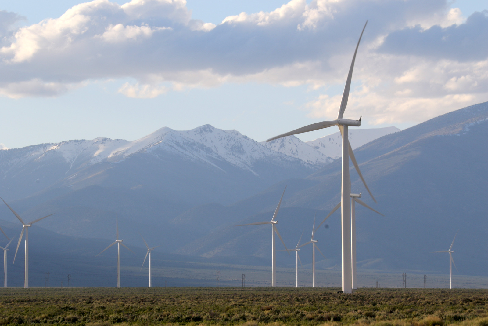
Then we learned a lot of interesting things about the wind farm. There are 66 turbines, each with a turbine size of 2.3 MW for a total project capacity of 152 MW. The blade length is 49m/161 ft. The project area covers 7,673 acres, and during operations 77 acres are being used. They have a 20-year contract and are in year 5 now. The project generates energy equal to the needs of about 40,000 homes.

The turbines were manufactured by Siemens, and they have a 10-year contract to do the maintenance. One of the maintenance workers showed us his industrial harness and all the attachments and explained what it was like to climb up inside one of the wind turbines.

Then we went into the work room and saw the monitor that showed nearby lightning strikes. They stop operations if lightning strikes are within 30 miles.

The turbines are also monitored by Pattern's home office in Houston, Texas, and by Siemens' home office in Denmark.

They had this really cool poster on the wall. There are blinking red lights on top of some of the turbines  at night for air traffic, but they try to keep all other lights really low so as to not disturb the night skies.

I like how the poster features bats. This project was quite controversial because it is located near Rose Guano Cave, a migratory stop for more than three million Mexican free-tailed bats each summer and fall. When they started in 2012, they were getting over 500 mortalities in a year (mainly due to bats getting close to the turbines and the change in barometric pressure causing their insides to rupture). Fortunately this story has a mostly good ending. Pattern Energy agreed to installing an infrared beam across the entrance of the cave to count how many bats are exiting. As many as 2,000 bats per minute can leave at a time. When the counts are high, the turbines don't start at 7 mph, but at 11 mph instead. Bats fly more at the lower wind speeds, and Pattern isn't losing as much revenue at that lower wind speed. The result has been a decrease in bat deaths, to about 100 per year. Bird deaths have always been lower than permitted, although about one golden eagle per year is killed. (This LVRJ article has more info.)

We saw a screen showing the status of each wind turbine.

While we were loading the bus, I got a photo of the substation. A big reason this wind farm was located here is that there are major transmission lines that pass through from Delta, Utah to Los Angeles, California. Pattern Energy sells all the energy they produce to Nevada Energy.

 It was a stormy day, with lots of passing clouds. The turbines were turning. They can turn up to wind speeds of 56 mph, then they are turned off to prevent damage.

We got off the bus at the last wind turbine before getting back on the highway. A few lucky kids got to wear helmets and get a little closer. Notice the snow on the ground, it was a cold day for late April!

Everyone else stayed by the bus.

We craned our necks up to look at the very tall wind turbine. Each turbine is taller than a football field--about 426 feet high!

Here's a truck for scale, but it still is hard to process how big these are. The blades at the ends can go up to 200 mph.

We watched, mesmerized.
Overall, it was a super interesting field trip, and I was glad to learn more about the wind farm. The employees there seemed very concerned about being good stewards of the land while they extracted energy from the wind.

Our day wasn't over, though. We headed further north to Cleveland Ranch, a ranch started in the mid-1860s by Abner C. Cleveland. This became the largest fenced ranch in Nevada for a time. Cleveland was a Nevada State Senator. You can read more about the history here , or for the definitive history, check out this free 440-page PDF by Lenora Healy (paperback version costs $18). The LDS church now owns this ranch.

The kids were treated to a hay ride.

The ranch is beautiful, but it was cold that day, as evidenced by these icicles.

We also went on a walking tour of the historic structures, including Cleveland's original log cabin and some of the storage sheds.
The kids were fascinated by the animals, and in the words of Desert Boy, "how cool all the old things were."

Thursday, January 9, 2014

Winter Views from the Train: Provo, Utah to the Rocky Mountains, Colorado

 Keeping with our travel theme, in this post I'll share some recent photos from a train trip we took. We departed Provo, Utah very early in the morning and arrived in Chicago, Illinois about 32 hours later. This post will cover just the first day.

The train was scheduled to arrive in Provo at 4:30 am, so we set our hotel alarm for 3:30 am. Upon waking, the first thing I did was to check Amtrak's website, which said the train was running 45 minutes late, so we went back to sleep. When we reawakened, the train was reported as on time, so we got ready and headed out on the slippery streets to the small one-room station. A number of other people were also waiting. The station had some heat lights, but as we kept waiting and waiting, we decided to take refuge in the van to stay warm. Apparently there was another delay, and eventually one of the folks waiting with us called and found out it was another 45 minute delay.
 The snow was falling heavily by the time the train arrived, and we sure were glad to get on! About 15 people boarded the train.

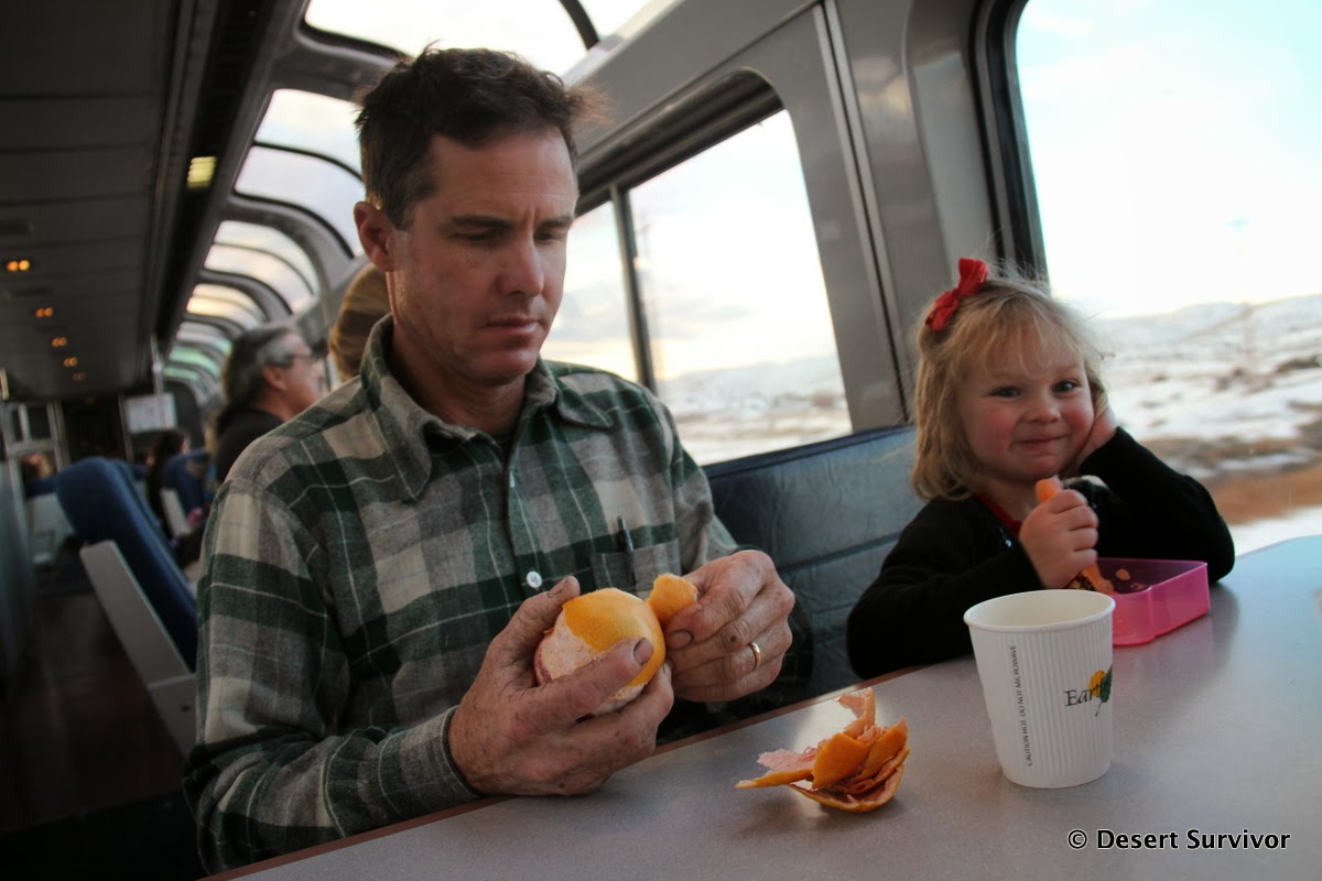
The conductor said the train was full, but had saved us four seats all near each other. We put our suitcases in the luggage bins, and went to our seats, where we dozed off till it got light. Then we headed to the observation car to eat the breakfast we had brought and where we could be a bit louder.
 The observation car is on top of the cafe, where you can buy a variety of drinks and food. The observation car has lots of windows, so it's a great way to see the terrain. The assistant conductor hung out there, sharing his vast knowledge of the countryside we were passing.

 And my, it sure was beautiful! The early morning sun lit up the Utah desert. At one point, far off in the distance, we could even see an arch from Arches National Park!

 The kids didn't seem particularly interested in viewing the surroundings, but they were eager to work on their activities. We had packed a number of them for the trip.

 "You are here"--I just loved it.

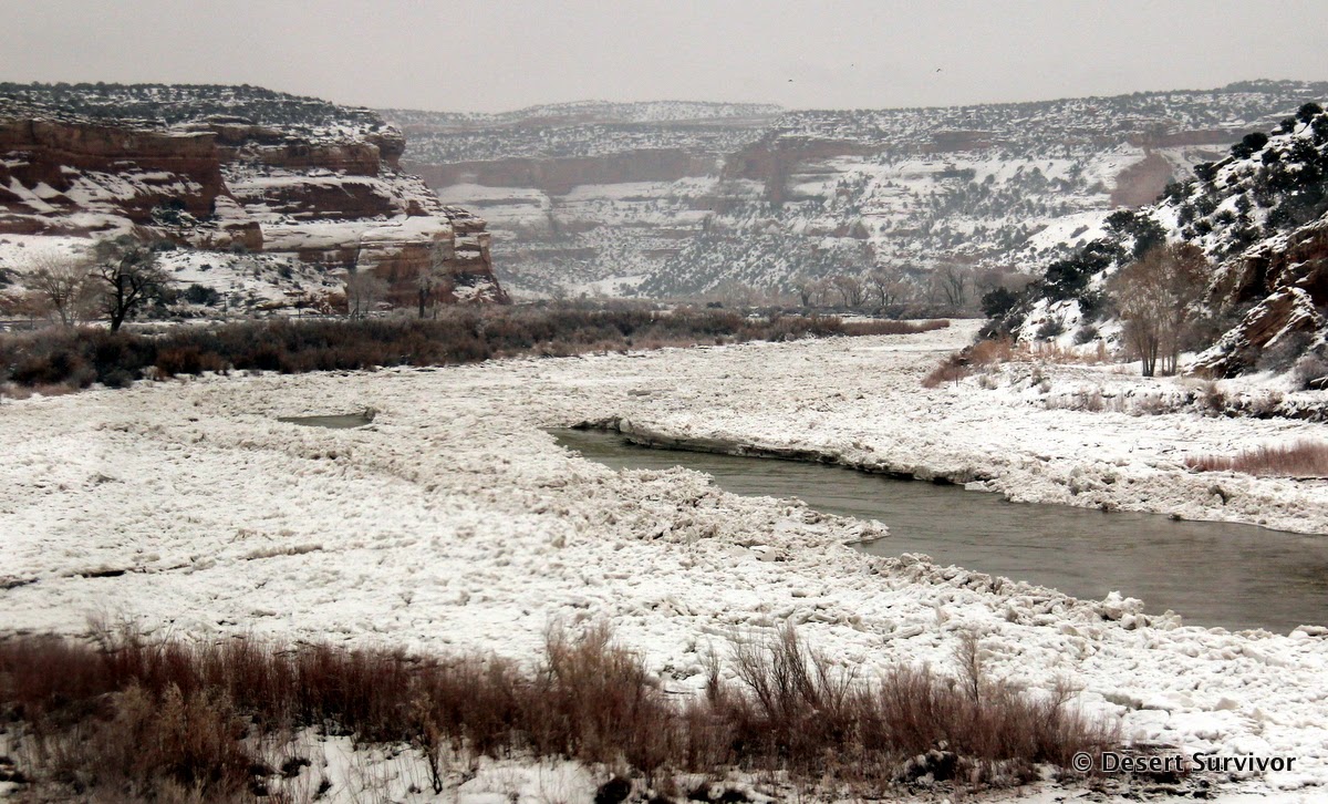
 The frozen Green River.

 As we entered this canyon past Green River, the conductor told us to look for the steps American Indians had carved into the sandstone cliff. The snow highlighted them nicely, and we all wondered how they had traversed such a steep place.

The Colorado River was amazing. I had done this section of train trip in June, with a swollen river roiling over its banks. I figured the river in winter would be serene. I certainly didn't expect the jumble of ice on the river, piling up in places, cracked, buckled, and floating in pieces only to jam up again. The ice was mesmerizing, and I spent hours watching it.

 When we reached Grand Junction we got off the train to stretch our legs. I think I appreciated it more than the kids! We checked out the station and the gift store and almost missed the train! Yikes, with just one California Zephyr running a day, it would have been a long wait for the next train!

 Just past Glenwood Springs we entered Glenwood Canyon, a steep section of canyon with the Interstate engineered to cross the Colorado River repeatedly, go through tunnels, and even be double decker for a short while. It's some of the most expensive Interstate Highway in the country.

 At Dotsero, the tracks left the Interstate and headed north, following the Colorado River. In places the river looked more serene, without so much ice buildup.

 Desert Girl chilling out.

 Since it was Christmas break, there were lots of kids on the train, and Desert Boy quickly made friends.

 I kept watching the ice on the river, which was forming huge blocks, breaking apart, floating downstream, and getting mixed up.

 It was a fairly cloudy day so we couldn't see any distant peaks, but just seeing the canyon made the trip amazingly beautiful. The scenery surpassed my expectations.

Later we retired to our seats for a nap. Then the kids watched a movie while my husband and I read, waiting for our dinner reservation. Finally it was time to eat, and then to sleep, dreaming while we were gently rocked to and fro, speeding along in the darkness.

...to be continued...

Sunday, January 5, 2014

Views from the Air: Las Vegas to the Midwest

We're back from an extended trip and I downloaded my cameras, only to notice that I still had photos from November on one of them. In mid-November I was lucky to spend a long weekend with my best friends from high school. In order to get to the Midwest, I flew out of Las Vegas and took some photos along the way. The Las Vegas Strip stands out prominently from the air, surrounded by large blocks of development.

 What surprised me were the large undeveloped blocks not too far from the city center. The golf course certainly stands out as an anomaly in one of the driest cities in the country.

 Just west of Las Vegas is some amazing geology. I'm not sure what the names of these ridges are, but they certainly look rugged.

 Part of Lake Mead National Recreational Area. This reservoir is huge! The contrast between the parched earth and aquamarine-colored water is striking.

Next came a variety of desert vistas. Soon, though, the landscape transformed from brown hues to white ones, due to a change in topography and elevation, which encouraged snowfall:
 Crossing the Rocky Mountains. Clouds hung to some of the peaks, and the mountains seemed to continue forever.

Nevertheless, the mountains did come to an end, a rather abrupt end. Then it was time for:
 Farming! The round circles indicated pivot irrigation, which means that this farming is in an area where the rainfall isn't abundant enough or predictable enough to provide sufficient amounts for crops.

 The rivers grew larger,  a marked difference from the desert environment to which I've become accustomed.

Finally it was time for more farming, but in much smaller parcels. The fields are in rectangles, so probably no additional water is needed for the crops.

It was so interesting watching the scenery out the window that I didn't need many other distractions during the nearly-four hour flight. Crossing much of the country on a clear day in a window seat is a great treat.

Do you have favorite sights that you like to see from the air?
Related Posts Plugin for WordPress, Blogger...

blogger templates