Showing posts with label mountains. Show all posts

Wednesday, September 4, 2024

3-Day Backpacking Trip in Southern Great Basin National Park - Day 1

Last year I started thinking about an ambitious backpacking plan in the southern part of Great Basin National Park. Start at the Snake Creek/Johnson Lake trailhead and head south on the Shoshone Trail, connect up to the North Fork Big Wash Trail and head east, then head back up (west) on the South Fork Big Wash Trail. Go down into the corner of the park near Lexington Arch, then go off trail to climb Granite Peak, the last of the over 11,000 foot named peaks I had yet to climb. Head to Mustang Springs for water, then up Highland Ridge to Lincoln Peak, Mt. Washington, and down the Snake Divide Trail to the trailhead. I figured it would take about three days and be about 30 miles. 

Well, I didn't get around to it in 2023, but I kept the idea in the back of my mind for 2024, and finally the chance came. I did a bit more prep, which included putting the route into Google Earth. I clicked on the show profile button. About 11,000 feet elevation gain! and loss! Was out of my mind or not?


My husband told me he wasn't' sure if I was in good enough shape to do this trek. I decided to go for it anyway. I had several outs. If I got too tired, I could hike out Big Wash, North Lexington, Lexington Arch, Cedar Cabin Springs, Decathon, or Mt. Washington roads. 

So I packed up and was pretty ruthless in keeping my weight down. The forecast looked great, with 0% chance of rain at night. That meant no tent needed. A puffy and a rain coat, but no fleece or soft shell. Tiny toiletries. I did decide to go for a sun umbrella, a very thin sleeping pad to put under my inflatable sleeping pad, and a stove. I should have skipped that last item. I'll get into that soon.

I started off from the trailhead at 7:18 am and in an hour was at the junction with the Snake Divide Trail thanks to a good trail. I headed over towards North Fork Big Wash on a little-maintained, recently washed out trail. It was a bit challenging in places, but not far and in another hour I was at the North Fork Big Wash. I was expecting to see a better trail here, but as you can see in the photo below, it was nearly non-existent. What had I gotten myself into?

Since the trail followed an old two-track road, I figured I could use my sun umbrella. 

However, the recent rains had created a flow as tall as my hiking poles and the trail was in bad shape, which meant lots of bushwhacking, which is tricky with an umbrella. At least with how I wanted to use the umbrella!

 As I progressed lower in elevation, the trail got better. I think some of the overgrown cottonwood sections caught a lot of the debris. Or maybe because the area is all karst, the water kept sinking in the ground. I reached the NFBW trailhead and saw recent vehicle tracks in the parking area. This was my first out. 

Did I want to quit?

Heck no! It wasn't even noon, and I was feeling good (going downhill helps, lol). 

 I turned the corner and started heading back uphill on the South Fork Big Wash Trail, re-entering the Park. The creek was running all the way out to the parking area, to my surprise. I took a quick dip in a waterfall/pool area near the park boundary. It was chilly, but felt so good!

I stopped at a favorite alcove with lots of amberrat and was happily surprised to see a packrat! Do you see him or her int he photo below? The packrats (also known as woodrats) leave these massive poop piles and also lots of vegetation and other things they find. Then they pass them down generation to generation, so the middens become treasure troves of information about past times. Sometimes the material becomes solidified into what's called amberrat. It sort of looks like candy. Just don't lick it (like some early travelers did). 


At the springhead for lower South Fork Big Wash, I took a nice break and replenished my water and dipped my shirt into the creek.


The SFBW trail was in decent shape and had seen some love in the not-so-distant past, with steps in some of the steep sections. I really enjoyed this flatter section through the mahogany.


I wasn't the only one who had enjoyed the trail crew's work. I saw scat from both bobcat and mountain lion (pictured below).


And later, when I got near a small spring, I found quite a few elk droppings. The elk used the upper part of the trail heavily, and I noticed that quite a few plants had been munched.


South Fork Big Wash has impressive limestone cliffs, and I couldn't help but look for caves. There's some potential, but they wouldn't be easy to get into!


Eventually I popped out at the boiler, the site of an old sawmill in a small meadow. There's also a dependable spring here, so I took a nice break. I had thought about camping at this location (approximately 10 miles from the Snake/Johnson trailhead), but I had energy, so I decided to keep on going. But first it was time to refuel. I wanted more than my Day 1 snacks. I had separated each day's food into a separate gallon ziplock so I would not eat all my favorite treats first and then have only the less desirable on the third day. I also had a bag of dehydrated meals and ramen. I decided this was a good place for some ramen. 
I got out my Jetboil. 
The auto lighting feature didn't work. 
Not a problem, I had brought a lighter.
The lighter didn't work.
Not a problem, I had backup matches.
Even with the matches, the stove didn't light.
Apparently the canister was out of fuel, even though I thought I had checked that!
Still not a problem. I had been watching a Facebook account of a lady hiking the Oregon trail and she talked about cold soaking her food. I had actually looked it up, and had read that if you soak your dehydrated food in cold water for an hour, it's fine. Two-three hours is better. So I put my ramen in a ziplock bag and put in cold water.

Meanwhile, a hummingbird entertained me for a bit.

I checked the ramen after about 15 minutes, and it was ready enough to eat, and I was starving, so I ate it. I filtered water as I wasn't sure of my next water source.

Then it was time for the uphill hike. I had spent a lot of time in this part of the canyon, helping to rehab it after its wildfire about 15 years ago. I was happy to see so much vegetation coming back and very little erosion. It looks like our work helped. 


These ponderosa pines are relatively rare in Great Basin National Park and were such a delight to see, especially since it was golden hour.


At the top of the hill I met a network of roads, some with fresh vehicle tracks. But I didn't see any people. I did see this cool group of bees (or wasps) on top of a flower head.


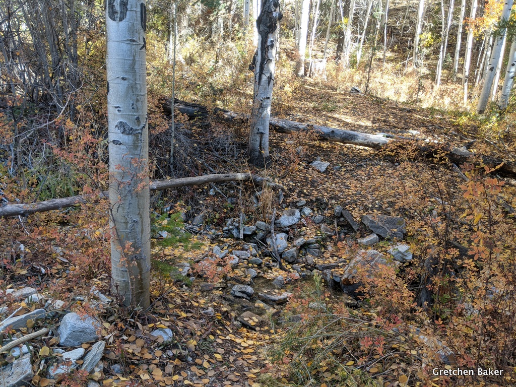
Before long I reached this little creek. I hadn't known if there would be dependable water, so I had filled up everything at the bottom of SFBW and lugged it uphill. No worries, I would just save time here. 


I found this old cabin, which I hadn't seen in many years. The back half has collapsed.

I wandered a bit to see what else was in the area and found a meadow with obvious elk use. The more direct road was washed out, so anyone trying to drive to this area had to go up and around (as shown by the vehicle tracks). This was another way out. Did I want it? Nope! I was ready to keep going. I kept exploring and found this tiny spring, with lots of elk sign around.

I also found this two-seater outhouse. I can only imagine the conversations held here.

By this time the stars were starting to appear, so I laid down and went to sleep. It was a great Day 1. 

What would I find on Day 2?

Stay tuned...

Tuesday, June 22, 2021

Notch Peak, Millard County, Utah - An Awesome Hike

Notch Peak dominates our eastern horizon, with its, 1,000+ foot cliff dramatic along the skyline. 

Fortunately there's a way to get up to the top of it that isn't too demanding, although I wouldn't call it easy. It's about eight-miles round trip, with 2,700 feet elevation gain (and loss). I've done it a couple times before, and this time we camped out with friends the night before (Miller Canyon has lots of options) and then started mid-morning with some cool temperatures. I highly recommend doing this hike when it's cool, as there's not a lot of shade along the way, and it gets very hot on a sunny, summer day.

The road off Highway 6 & 60 to the Amasa Basin junction is good for even regular cars. Then it's high clearance for the next 1-2 miles to get to the Notch Peak Trailhead in Sawtooth Canyon. 

Soon one of the kids had caught a lizard. Fortunately we had a herpetologist in our group!

The kids got a chance to hold it.

What fun!

Then it was on to more hiking, with occasional surprises like beautiful wildflowers.

When we stopped for lunch, I took a closer look at the trees around us. I spotted four different cone-bearing trees. Do you know this one? The "mousetails" sticking out from the pinecone are a big clue.
This is a Douglas fir tree.

I gathered up pinecones from the four trees. Do you know them?
Starting at the top and going clockwise: bristlecone pine (note the bristles on the pinecone), Douglas-fir (with the mousetails), white fir (small and plain), and pinyon pine (large spaces between the scales to hold the pinyon pine nuts, which most likely have been eaten by rodents and birds). 

I also found this snail shell. What? Snails in the desert? Yep! These are land snails, probably of the genus Oreohelix. They usually don't move more than 100 yards from where they came to life, and prefer talus slopes with limestone rock. They hibernate and aestivate (stay dormant in the heat of the summer). This one is dead, it's just the shell.

As we moved up canyon, we found all sorts of obstacles. At one point there were a lot of trees down in the canyon.

We found some rock cairns off to the right (north) and followed them. Big mistake! That scrambly trail is a mess. It's a lot better to stay in the canyon (except maybe in winter). 

This alternate route did go by this cool cliff.

We took a break looking down canyon and watching some other hikers who were as confused as we were about where the trail was. 

Finally we got up to the saddle and had our first glimpse of the amazing canyon down below.

From the saddle you can see the way up to the top. There's not much of a trail, but it's not hard to go through the bushes. And fortunately, that's not a false summit at the top, it's the real summit!

The top then drops away to the cliff.

We looked at the completely full trail register at the top.

Then it was time for snacks and waiting for our entire group to make it up.

Looking down might give you a little sense of vertigo! This is a place base jumpers occasionally climb up and then sail off. 

Here's to friendship! It was so lovely doing this hike with friends. We did it on Mother's Day, as we figured our families had to do what we wanted that day. Ha! It was good to get out.

There's a US Coast & Geodetic Survey marker from 1957 on the top.

We still found some snow in May in places in the canyon.

I enjoyed seeing this maple tree, we don't have many maples around here!

The kids at the beginning of the hike. I wasn't sure they were all going to make it, but they all persevered. We left the trailhead about 10 am and returned about 6 pm. I think with fit adults, you could do the hike in about 6 hours. 

Bonus biology photo: a solfugid, or wind scorpion/camel spider. They're rather uncommon, so I was so excited to see one. 

I highly recommend the Notch Peak hike for anyone who likes climbing desert mountains. Just don't go when it's too hot! Here are some directions. And a previous Desert Survivor post about this hike

Wednesday, October 14, 2020

Hendry's Creek Trail, North Snake Range, Nevada

Overview


Hendry's Creek is a long drainage on the east side of the North Snake Range. It has been home to Bonneville cutthroat trout (BCT) for millenia. Mt. Moriah tops the drainage at 12,050 feet. Several springs join to make a creek that flows over 15 miles out into Snake Valley. 

The Hendry's Creek trail is amazing, over 10 miles going from 5,921 ft elevation up to 11,018 ft at the Table, a high elevation plateau. Do not attempt this trail during high water. There are 14 creek crossings plus numerous spring crossings. Peak streamflow is usually mid-May to late-June. If it is difficult to get across the first creek crossing, it will be difficult many more times. In late summer/autumn, you can do the trail without getting your feet wet (with some care). If you don't want to do all 10 miles, the first 1.5 to 2 miles gives you a good taste.

Getting There

From US Highway 6/50 (near the Border Inn on the Utah/Nevada stateline), take the Gandy Road about 9 miles north. Where the road curves, go straight to the stop sign. Then go past a big rock monument that says "Hatch Rock." Reset your odometer here.


  • 0 Hatch Rock
  • 2.7 Cattle guard
  • 2.8 Road junction-go straight
  • 2.9 Road junction, go right on the fainter road, aiming towards the canyon. You will soon see some ponderosa pines ahead in the drainage.
  • 3.2 Road junction, stay left
  • 3.5 Big campsite
  • 3.7 Little campsite in water birch
  • 3.9 Trailhead

Trail Landmarks

These mileages are from my Garmin watch, which said it was 10.3 miles up and about 10.1 miles down. 

  • 0 Trailhead
  • 0.1 1st creek crossing, watch for poison ivy
  • 0.5 Claim marker-white post with rocks around it; big ponderosa pines
  • 1.0 2nd creek crossing (dry in Oct 2020)
  • 1.5 3rd creek crossing (dry in Oct 2020), look for bristlecone pine on left side just after crossing, then Mt. Moriah Wilderness boundary
  • 2.0 Garnets and staurolites
  • 2.8 4th creek crossing
  • 3.1 5th creek crossing
  • 3.7 6th creek crossing
  • 4.0 7th creek crossing, more aspens
  • 4.2 huge ponderosa pine
  • 4.5 spring across trail, lots of horsetail/scouring rush
  • 4.7 8th creek crossing
  • 5.2 campsite in aspens with arborglyphs, 9th creek crossing
  • 5.3 10th creek crossing
  • 5.7 big campsite
  • 6.0 11th creek crossing, spread out, follow rock cairns
  • 6.7 12th creek crossing
  • 6.9 13th creek crossing
  • 7.0 14th creek crossing
  • 7.1 big campsite in aspens
  • 7.4 canyon with creek heads left/north
  • 7.6 spring brook along creek
  • 8.0 Bristlecone and limber pine on either side of trail
  • 8.3 View of Mt. Moriah
  • 8.4 Tiny spring, last water in Oct 2020
  • 8.5 Start up switchback up hillside
  • 8.8 On ridge, head west again
  • 10.3 Trail junction and sign (Big Canyon 006, Hampton Creek 077, and Hendry's Creek 078); You're on the Table!
  • 11.3 Other (west) side of the Table and cell service (AT&T and T-Mobile)

 The Details

I had the whole trailhead to myself. There was a hunter's tent and vehicle at the big campsite. I had left Baker, NV in the dark and when I arrived at the trailhead, the sun was just reaching the taller peaks.

The first stream crossing is at just 0.1 miles. It was easy to stay dry, and with drought conditions, the poison ivy wasn't noticeable at all.

The first part of the trail goes through sagebrush and rabbitbrush. About the first five miles are part of an old road, which is sometimes easily distinguishable and other times not.

About 0.5 miles in is a mining claim marker. You will see these all over the hills around here, they mark someone's mining claim. Some are still current, but many are historic.

 
The rising sun made the tall ponderosa pines stand out.

The 2nd creek crossing was dry. During late summer, this section of the creek can dry up.

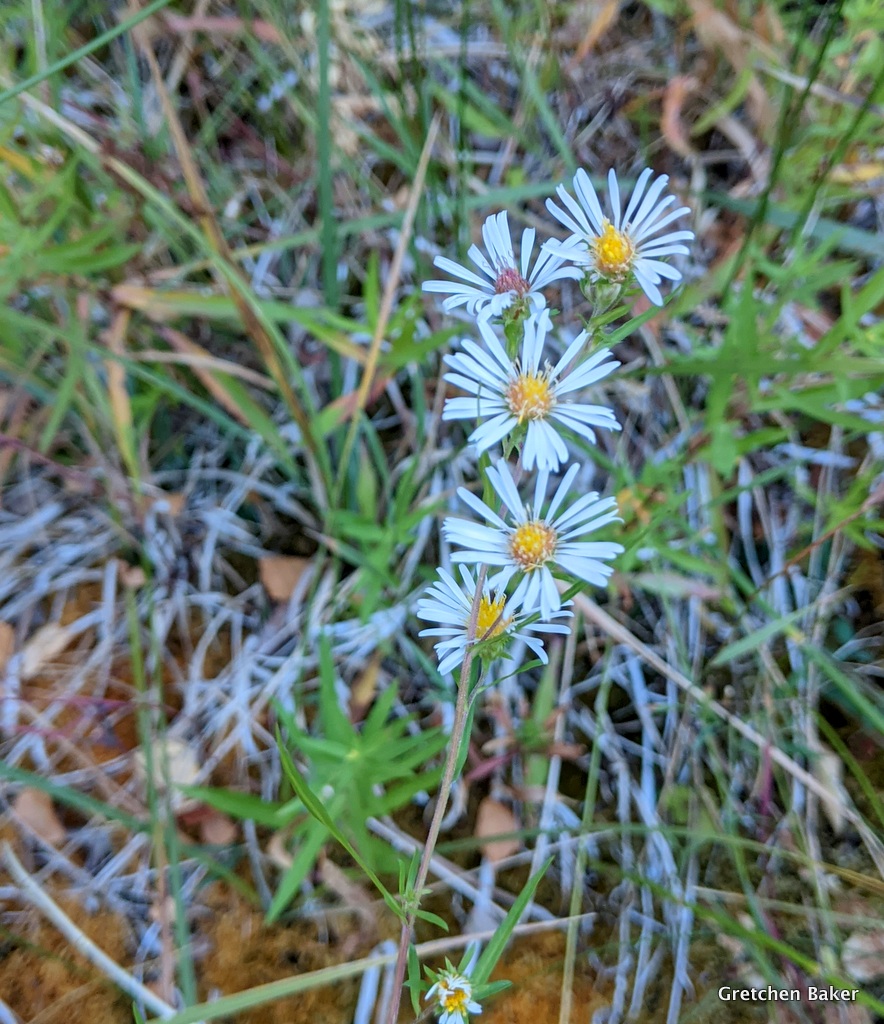
I was happy to see some asters in mid-October. Earlier in the year there are so many flowers blooming. You can see a sampling of spring flowers in this post and summer flowers in this post.


 The rock surrounding the drainage is quartzite. You can find more about the geology here. The beautiful rock is quarried nearby by Mt. Moriah Stone. We have a beautiful patio made of the rock. 

 
The 3rd creek crossing was also dry.

Just past the third creek crossing, look to the left (southwest). Do you see a tree that looks out of place? The one with the Dr. Seuss-like bottlebrush branches is a bristlecone pine. It's way below where it's supposed to grow.

Just a little bit farther, at about 1.5 miles from the trailhead, you enter Mount Moriah Wilderness.

The fall colors were beautiful, with the skunkbush vibrant red in places.

Someone had written in the trail register that they were going 2 miles in to look for garnets and staurolites. When my watch beeped 2 miles, I looked down and saw garnets! They are in a schist that is apparently about 25 meters thick. This is an area I'd like to spend more time in.

4th creek crossing--water again!

The goldenrod was going to seed.

5th creek crossing

6th creek crossing

I noticed some maple leaves. Maples aren't common around here, but there are a few if you know where to look. (Grey Cliffs in Great Basin National Park is another location.)

7th creek crossing. This is about 4 miles up trail. A few aspens appear.

Soon after this creek crossing there are a bunch of ponderosa pines.

A really large one all by itself stands out.

The lower bark is charred, but looking up at its branches, it looks vibrant.

A bit farther on is a spring area with lots of horsetail (Equisetuum sp.), also called scouring rush. It can clean out your cooking pot well.

Some fireweed that had gone to seed glowed in the sunlight.

8th creek crossing. You can see many more aspen trees now.

I liked the rock layers next to the trail.

I wondered about the root system of the ponderosa on top.

Most of the trail was clear, but there were some really big trees that had fallen over it and made for some obstacles.

The first defined campsite with a fire ring is at about mile 5.2.

9th creek crossing.

I liked how these tall aspens looked contrasted against the sky.

I missed a photo of the 10th creek crossing. The 11th creek crossing was weird, the stream was split into several channels. I saw a BCT in one of the channels on my way back down.

A burned snag with wolf lichen on it caught my attention. We don't have much shaggy lichen in this area, but this tree was covered with it.

12th stream crossing. The creek is getting a lot smaller.

Oh, the colors! I wasn't expecting them after the previous tall, almost bare aspens, so they came as a wonderful surprise.

The aspen leaves were like a colorful carpet.

  13th creek crossing.

14th creek crossing. I was so confused here, because I was on the south side of the creek and knew I would be going up the north side of the drainage. In about 0.4 miles, the creek goes up a side drainage to the north.

 Another big, defined campsite at mile 7.1. Lots of arborglyphs (writings on the trees). A bunch from the 1930s and more that were newer. The old ones are cool, recent ones I consider vandalism.

 Although the main creek went away, a little brook appeared next to the trail, sometimes dry and sometimes with water.

Just a short distance above here I met up with a hunter. He said he was on his 80th birthday celebration and had just spent two nights in the backcountry. He had a buck in his gunsight two different times, but didn't shoot because it was too far to get back, and with all the trees down would take even longer. I was so impressed with how big his pack was and how happy he was to be in the backcountry.

 A bit farther ahead I had a view of Mt. Moriah! A tiny spring was the last water available at mile 8.4.

At mile 8.5, the trail made a big turn and started up the hillside. In about 0.3 miles, I reached the ridge and headed west again.

I went through a big area of recent mountain pine beetle kill. They had attacked the limber pine.

It was great seeing Mt. Moriah getting closer and closer!

At mile 10.3, I reached the trail junction on the east edge of The Table! I was really happy. I started on the Big Canyon Trail, which crosses the Table.

The east side of the Table is rather plain. This high elevation plateau is also rather flat.

Off to the northeast I could see the lakebed to the east of Gandy (Gandy Salt Marsh) and the small mountain range just beyond it, then the Confusion Range and the Fish Springs Range.

As I walked along the trail, I was in for another surprise. A bunch of bighorn sheep were grazing! They ran away from me and then started grazing again.

I couldn't resist visiting a couple of my favorite bristlecone pines.

This one I've featured in some night time photos.

I even found a rock in the shape of Nevada.

The surprises weren't over. While I was eating lunch watching the bighorn sheep, a friend appeared! He had come up from the Big Canyon side and was going to attempt Mt. Moriah. As much as I wanted to join him, I knew I still had 10+ miles to go. There's not really a trail up the mountain, but gave him some general advice based on our summit in 2014.

As I headed back down I noticed all the baby bristlecones.

As I journeyed downhill, I didn't take as many photos as the way up, but I still had to stop from time to time.

The Hendry's Creek trail is just so beautiful. I also appreciated how less rocky it is compared to the trails in the South Snake Range, which cover more previously glaciated terrain, so there are more moraines and glacial outwash features, and thus many more rocks.

 
It looked like these aspens had eyes and were watching me.

I noticed different arborglyphs on the way down, some from people I knew. It took me awhile to figure out who BC was, but I eventually got it.

 
And then I was in for a huge surprise in a tiny little package--a snake only about a foot long with bright markings. It's a Utah mountain kingsnake, a very secretive snake. It was right in the middle of the trail. I bent over to get some photos of it.

I've gone out on kingsnake surveys before, trying to find these elusive creatures. And here I wasn't even looking for one and managed to find one, and in mid-October. What a great way to end my hike.

Fall is such a great time to take this trail. The water is low, the aspens are gorgeous, it's not too hot, and the wildlife is amazing!

I finished my trail run/hike about 10.5 hours after I started, as the sun was getting low in the sky. I will be going back, and either I'll have to go when the days or longer or will have to get faster! :) Or backpacking is a terrific option, then you can can spend more time enjoying the great scenery and can explore even more.

This is a great place to go hiking if you want some solitude and lots of beauty.
Related Posts Plugin for WordPress, Blogger...
blogger templates