
Tule Valley turns out to be a great place to go recreate responsibly. There's just no one there. And with a little common sense, your chance of getting injured is extremely low. So what can you do? We're going to focus on the northern section in this post. Southern Tule Valley is more well-known, and you can find past blog posts on Ibex Crags (bouldering and rock climbing) and Ibex Hardpan (bike riding, airplanes, and aliens).
In northern Tule Valley, on the east side, there are some tiny sand dunes, just right for kids and kids-at-heart.

I don't think they get more than 40 feet tall, but they show awesome patterns.

In the background you can see the pointy Tatow Knob. If you're into hiking, you can see bristlecone pines on the way to the House Range's tallest peak. The most popular peak to hike is Notch Peak, and the view of it from Tule Valley is amazing. We couldn't see it from where we were, but a bit farther south it is great. Painter Spring, with rock climbing and cool minerals is also farther south.
Rabbit tracks in the sand.

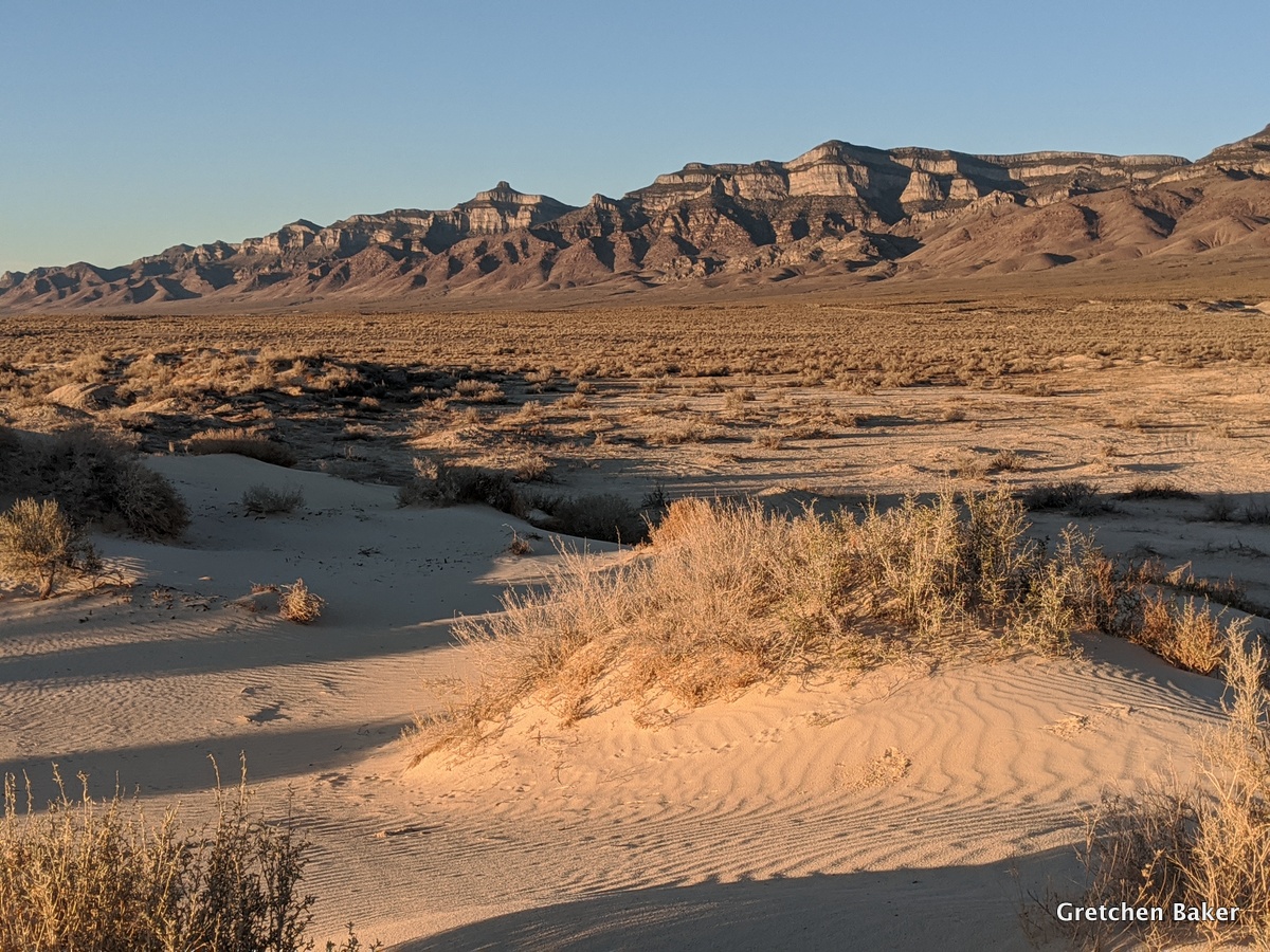
Tule Valley has the House Range to the east (photo below), the Confusion Range to the west, the Fish Springs Range and Great Salt Lake Desert to the north, and the Wah Wah Valley and Mountains to the south.

At night the stars are marvelous in Tule Valley.

We'll have to go back for more Milky Way photos. In May just after sunset, the galactic core hasn't risen yet.

One of the biggest features in northern Tule Valley is a huge dry lakebed. With only 8 inches average precip for the entire valley, there's not enough water to go anywhere. Plus, Tule Valley is in the hydrologic Great Basin, which has no external drainage. All the water that falls either enters the ground or evaporates. During really wet periods, water does accumulate on the playas. And from about 21,000 to 15,000 years ago, this area was under water when the massive Lake Bonneville extended down this far. Ancient shorelines can still be spotted (check out this video about how lake levels fluctuated). Sometimes it's fun to pretend that we're scuba diving and what creatures we would see in the lake with us.

Hardpans or playas are just so much fun. You can go where ever you want! I wrote a fun post about playas and their many uses in 2012.

I was attracted to the patterns on the playa.

Meanwhile, back on the dunes, Desert Boy was still sleeping.

So much of Tule Valley is dry. But in the middle of the valley, Tule Valley springs bubbles. The word "tule" means large bulrush.

It was fun walking around Tule Spring.


In Upper Tule Spring, not far from the corral, we even caught a Columbia spotted frog (Rana luteiventris)! Even more reason to protect the scarce water out there. But you might not want to go for a swim--from researching this blog post, it looks like there might be leeches in the springs, too!

Tule Valley isn't for everybody, and that's a good thing. It's quiet and isolated, remote and subtly beautiful, hot in the summer and freezing in winter. We look forward to visiting again.


No comments:
Post a Comment