Sunday, June 22, 2025

Early Season Ascent of Wheeler Peak, Great Basin National Park

It was May 26, and three of my brothers wanted to summit Wheeler Peak. Well, at least one of them wanted to and the rest of us were willing to go along with it. We got to the trailhead about 8:30 am, which seems to me like a late start, but this early in the season there's usually not the threat of afternoon thunderstorms. Instead, we ran into another problem, which I'll get to later.

There wasn't much snow on the first part of the four-mile long summit trail, but as we progressed, we found more.

Desert Girl was doing some training by carrying her cousin. The plan was to take him part way up the mountain, then his mom would take him down. He made it about 1/3 of the way up.


We crossed some very snowy sections and were glad to have poles. We also had microspikes, but didn't put them on till later.


As we headed above treeline, the kids surged ahead. The rest of us were wanting more oxygen.

It's both daunting and beautiful coming up that first false summit and then seeing the peak far off in the distance.

Looking back we see we are higher than Bald Mountain, to the north.

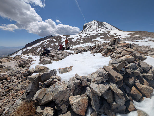
The big ridge had the wind shelters still full of snow.

And snow was the theme the rest of the way up. Although there were rocky patches, most of the way up was in the snow. 

In some places, the snow was easier to traverse than the rock.

I saw several of these Hemiptera, or true bugs.

The first time I go up a big peak each year is always the hardest. For this trip, I took 10 steps and then paused and took a couple breaths and repeated. 

For a short while I was even above Desert Boy. We could already see a long way off.

And then we were almost to the top!

We found the faster members of our group hanging out. This included Desert Girl, Desert Boy, and my nephew.

The view to the south was gorgeous, looking down into the North Fork of Baker Creek, Baker Peak, Pyramid Peak, Mt. Washington, and the Highland Ridge.

My daughter and nephew walked with me along the summit ridge towards Doso Doyabi, past the wind shelters and old heliotrope stations. These were used to help map the 39th parallel. You can read much more in the bood Geodesy: the transcontinental triangulation and the American arc of the parallel," 1900, US Coast and Geodetic Survey. I did not read it, but I did check that it's on Google Books at: https://books.google.com/books?id=--MNAQAAMAAJ. On page 334, it shows the measurements from Wheeler Peak to Tushar Mountain (near Beaver, UT), Mt. Nebo (near Nephi, UT), Ibapah Peak (near Callao, UT), and White Pine Peak (lost in NV).
p.s. You can learn more about Heliotropes on Wikipedia, including that someone using one could be called a "flasher."

Here they are, with Doso Doyabi obviously lower in the background.

The views were spectacular all around. Here's the ridge we had just climbed, with Stella and Teresa Lakes looking like little ponds in the right-center part of the photo.

As the clouds built, we gathered for a group photo.

We signed our names in the register, and then it was time to head down, with microspikes on.

We gave sliding down a try. It worked better on a jacket, as the snow was quite wet.

We had to be careful not to veer to the left, or we'd have a long hike into Spring Valley.

Remember how I said at the beginning that a later start might have a drawback? This was it. We found the snow was now very soft, and the postholing was awful. There were tears. 

But we did it! What a day.
This was one of the harder times for me to climb the peak, not only because my body wasn't so acclimated, but also because so much snow made it rather tough. I was so proud of my nephew, doing one of the hardest hikes of his life (so far). 

Tuesday, June 17, 2025

Sub-alpine Lakes Loop and Bristlecone Trails, Great Basin National Park

We had family in town, it was the end of May, and it was time to check out some of the higher elevation trails! With only about 65% snowpack for the 2024-2025 winter, the Wheeler Peak Scenic Drive opened just before Memorial Day weekend, allowing easier access to the snowy trails.

We started in the parking lot with some silliness.

Then it was time for the before photo. We were prepared with hiking poles and microspikes for most. Footwear and clothing varied.

This stump chair is always a favorite!

We found a lot of snow on the trail to Stella Lake.

 Fortunately the snow lessened as we got on more south-facing slopes.

I was surprised to see so much ice still on the lake. The snow above it looked patchy.

The trail between Stella and Teresa Lakes was about 60% covered in snow. Fortunately someone who knew what they were doing made the first tracks, which lined up with the orange trail markers on the trees.

When we got to Teresa Lake, we saw that it was about double the size from a few days previous, but still small. The inlet stream was barely flowing.

Then our group split, with some going on to the bristlecones. The north-facing slope was quite treacherous.

My nephew fell, but fortunately stayed on the trail. And he even smiled!

When we turned the corner, the conditions improved a lot, and soon we were in the bristleone grove, admiring these old beings.


And why not give the tree a hug?


I also encouraged touching the bottlebrush-like needles. They feel so nice.

It was definitely good we had microspikes this early in the season. A couple weeks later and they weren't needed. 

The Bristlecone Trail and Sub-alpine Lakes Loop are two of the busiest trails in the park, and for good reason, they are beautiful. Fortunately, Great Basin National Park doesn't have super high visitation, so you can still have a true national park experience. However, parking is limited, and on weekends and holidays, it's best to arrive before 9:30 am or after 3:30 pm to snag a parking spot.

Sunday, June 15, 2025

Sage Steppe Loop and Old Osceola Trail, Strawberry Creek, GBNP

It's great to have family visit, because it's a good excuse to get out hiking! For an easy morning hike, we headed over to Strawberry Creek. We were hoping to see some elk or deer on the drive up the scenic canyon road. Alas, they were somewhere else, but we did see something we stopped for:

A Great Basin rattlesnake! And it was in the middle of its breakfast, complete with a mouse tail protruding from its mouth. This was so cool. It only had a handful of rattles, so this was a rather young snake.

It moved off the road into some Oregon grape and sagebrush, and we left it in peace.

When we got to the trailhead, we were the only vehicle. We started off on the 1.2-mile long sage steppe tour to the left to go clockwise. The trail quickly enters a burned area.


The kids seem to appreciate extra challenges, which I was happy to give them.

We took a little break at the bridge at the top of the loop.

Just beyond is a trail junction sign. If you go left, you are on the old Osceola Trail heading to the collapsed tunnel and Weaver Creek. I had never taken the trail before, and the rest of the group was amenable to giving it a try.

The trail was easy to follow, being in a ditch. Even though the ditch is more than a hundred years old, it's still a ditch. Until you get to the end, when it just suddenly ends. This is where the tunnel would have been, but it's so thoroughly collapsed, you don't get much sense that there had been a tunnel.

Instead of heading back down the ditch to reconnect to the Sage steppe loop, we decided to head cross country. Under this tree we found piles of fence posts.

We had to zig and zag to avoid some of the taller veg, but eventually we made it back to the trail.

And there was enough energy for one more challenge!

I highly recommend the Sage steppe loop. It's a neat view of a burned area, is short and not too steep, and during the summer has lots of flowers blooming.

The Osceola tunnel trail is one that can be skipped. There is not much to recommend it.

Related Posts Plugin for WordPress, Blogger...

blogger templates