Showing posts with label Desert Boy. Show all posts

Sunday, April 10, 2022

Hike up the Abandoned Big Pine Road

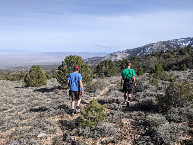
On a warm spring day, my husband, son, and I decided to go for a hike. We left the house without a firm goal in mind, and as we were driving up the Baker Creek Road in Great Basin National Park, we decided to stop at the old Big Pine Road. It starts with a small meadow and then we huffed and puffed our way up (at least I did) a steep slope through pinyon and juniper up to a ridge. We started seeing snow banks.

Desert Boy wanted to turn around, but we kept going until we could eventually see some of the big pines, aka ponderosa pines. They were down in the gully. I had a faint recollection of hiking to the spring in this area about 20 years ago. My husband remembered as a young child bouncing in the back of a pickup truck up the road (in a 4WD vehicle that didn't have low gear, so they had to go rather fast and hold on tight). He said his older brother and sister didn't enjoy moving cows up into this area (which was Forest Service at the time), because the slope was steep and it wasn't obvious to the cows that there was good grazing and water ahead, so they didn't want to go. One time he fell asleep near the spring and everyone started looking for him. When he eventually woke up, he asked what all the shouting was for. 

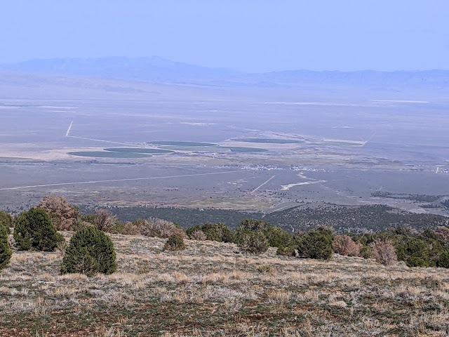
The views of Snake Valley are quite nice. I was particularly drawn to the Baker Creek overflow channel, just slightly to the right of center of the photo, the jagged white line. The straight line is the concrete ditch that takes 26 cfs of water down to town--otherwise it sinks into the alluvium and wouldn't get to town. On big water years, the excess goes in the overflow channel. This only happens every few years, because we just don't have much water here. 

I was enjoying getting my blood flowing, hearing stories, and also seeing spring flowers. Here are snow buttercups, one of the first flowers to emerge along the Baker Creek Road.

The Big Pine road has been abandoned for at least 25 years. Nature is slowly reclaiming it.

Here's a desert biscuitroot blooming.

I'm not sure of this yellow flower, maybe a bur buttercup.

And this is a Blue-eyed Mary, so tiny.

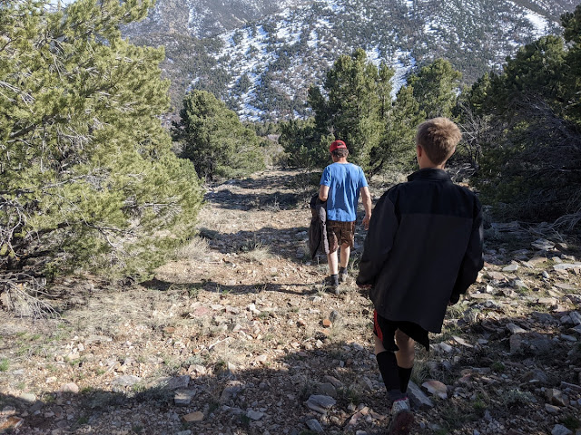
The abandoned road quickly got very steep.

I noticed a lot more old cable on the way down than on the way up. They used the cables to move the cut ponderosa pines.

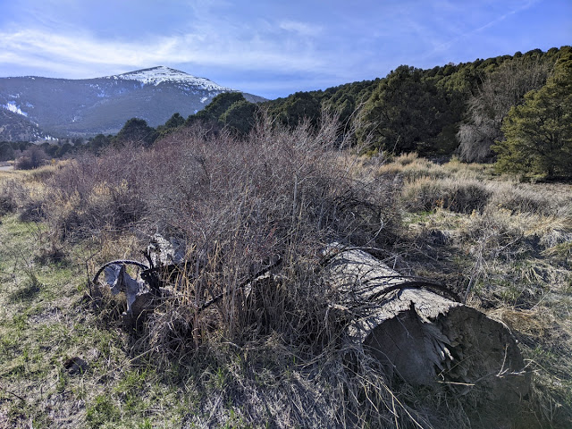
Down at the bottom we found some of the huge logs with cables around them disguised by the rose bushes.

It was an interesting outing, and we're hoping to head back up there and go all the way to the spring.

Monday, April 5, 2021

Spring Break in Death Valley National Park

The kids wanted to go somewhere warm for spring break, so we decided to head to Death Valley. I had taken them to Death Valley eight years ago, but they didn't really remember it. Maybe this time they will! We took off from Beatty and headed to Titus Canyon and got out a couple bikes so we could take turns riding down the fun canyon.

We had managed to reserve a site at Furnace Creek Campground for one night (spots are scarce!), and got in some sleep despite a massive wind storm that night. The next morning we headed off early to the lowest elevation spot in the western hemisphere, at Badwater Basin. Desert Girl tried to hold her breath at -282 feet below sea level. The mountains are a little hazy because of all the dust in the air.

Flashback: here they are eight years ago! 

Desert Boy liked Devil's Golf Course with the interesting salt formations.

We found an interesting arachnid in a canyon. Maybe a solfugid?

We explored an unnamed side canyon so we skipped Golden Canyon, which had a full parking lot and cars spilling out onto the highway. We continued north to Harmony Borax Works, where we learned about how borax was extracted and concentrated. It was quite interesting. I can't imagine the work, it sounded quite awful, with boiling cauldrons and terribly long transports.

Spring is a good time to visit Salt Creek to see the mating pupfish. The species that lives in this spring is endemic (only found) in Death Valley. We saw hundreds, maybe thousands, of them. In a couple months, the water will dry up near the boardwalk. Hopefully some of the pupfish we saw will make it closer to the headwaters to survive.

I enjoyed this exhibit about what the area would have looked like during Pleistocene times.

I had wanted to see Scotty's Castle area, as I worked there 24 years ago. I knew that it was closed due to flooding, but I didn't know that the road to it was closed three miles down, including closed to foot and bike traffic. Instead we went over to Ubehebe Crater. When I worked at the park, that was a five-minute stop for most people. We found a full parking lot and lots of people picnicking and hiking. 

The kids and I went around the crater, about 1.5 miles hike. We saw lots of people. And some googly eyes.

Little Hebe Crater was cool. Beyond it we could see the backcountry road we would soon be embarking on.

It led us to teakettle junction, which sports a plethora of teakettles.

Maybe because of the little sign in the corner: Take nothing but pictures, leave nothing but teakettles.

From there we headed to the Racetrack. I couldn't remember exactly where the moving rocks were on the dry lakebed, so we wandered a bit. We found this cool lizard.

And eventually we found rocks and trails. So cool!

We investigated a few.

Then it was on to our backcountry camp, the Homestake Dry Camp. I was surprised by how many people were there, 11 groups at the camp itself, plus another 1/4 mile down and another 1/4 mile up from the camp. 

We were higher elevation, so it was cold, in contrast to the balmy night at Furnace Creek. The next morning we got up and explored the nearby mine. The kids showed their dance moves on a big slab of concrete we found. (Wow, pouring concrete that far out!)

We had fun checking out an old car.

This mine (Lippincott?) was quite well preserved.

Some idiots had cut through the protective netting and descended into the adits. I love caves, but know that exploring mines is much more dangerous. I like the mantra, Stay out, Stay alive. We found very crumbly rock near the entrances of the mines, and some had multiple rocks on the floor, so we stayed out.

A horizontal adit had also been breached. Sure, those tracks look inviting, but we stayed out.

Next came a road I had never been on, the Lippincott Road. It wasn't on the park newspaper map, but I knew it existed. There was a sign at the beginning warning that 4x4 high clearance was needed, no tow service, and use caution.

I wanted to do it on my bike and found a few sections so steep and rocky that I walked the bike. 

The road didn't look too bad from a distance.

But up close there were some really rocky parts that took full concentration. My husband did very well.

I found an old "Entering Death Valley National Monument" sign. The park boundaries were expanded when it became a national park in 1994. 

We weren't the only ones on the road. Four vehicles followed us at a distance. We passed one guy who was "just out exploring" and wondered what road this was and what it was like. He planned to go uphill in his 4WD pickup. Going downhill is enough adventure for me (and enough bumpiness). 

When we exited the canyon we were in Saline Valley. To the north are clothing optional hot springs. We headed south to get to pavement, which didn't look that far on the map, but took over two hours. We passed many more vehicles. That was the thing that has changed the most since I worked there--Death Valley is so popular now, even the remote backcountry places. It's gorgeous, but you really have to be prepared to go into the backcountry. We saw one vehicle changing a flat tire but fortunately avoided any ourselves. 

We headed to Stovepipe Wells and secured a tent camping site on the edge of the 195-site parking lot (the tent sites on the edge get a bit of sand). Across the road you can get a pool pass for $5/person, which we happily did, as it was over 80 degrees. A bit later we went up in Mosaic Canyon, ordered a take-out meal (no dining in permitted), and wandered into the sand near our campsite.

After another beautiful night (the night skies are amazing in Death Valley), we woke up to clouds with a bit of sunshine. It has been so dry that we only saw a handful of flowering plants. This was quite a change from my visit for 2016's Superbloom. Fortunately, one of our favorite Mojave Desert plants, desert creosote, was blooming.

It happened to be April 1 when we were in Death Valley. An owl magically found its way to us and dropped off Desert Girl's acceptance letter to Hogwarts. She was not amused. 

Our last stop before heading home was the sand dunes. The big parking lot is another change, and much safer than when people just parked along the side of the road.

We found some dunes that were tall enough for good rolling.
By 9 am, it was getting quite warm. If you visit much later than that, you probably will have to wear shoes. We really liked going barefoot!

It was a lovely trip, and we were grateful that everything went smoothly. Our only hiccup was a delay when tow trucks pulled up a Fed Ex trailer from the side of the road. 

Death Valley National Park is a great spot to visit in fall, winter, and spring. Do plan where you're going to stay at night, as it is getting very popular, and that may influence your itinerary.

Thursday, December 10, 2020

Finding the Lost Strawberry Creek Cabin


My husband wanted to visit a hidden cabin up Strawberry Creek drainage in Great Basin National Park. He used to go to it as a teenager, when his family had grazing rights in that area and before it was a national park. The grazing rights were retired in 1999, the road to the cabin was abandoned, and now it's really hard to get to. We decided the easiest way was to climb up and over Bald Mountain and then hike down into the drainage.

There's an old weather station on the top of Bald Mountain. It doesn't work anymore, as the winds can be ferocious up there.

One of the best views of Wheeler Peak is from the top of Bald Mountain.

We decided to take a family photo with that great background.

There's a big rock pile and a stick at the summit. Fortunately it wasn't very windy, so we enjoyed a snack. We kept an eye on the clouds, which were building.

Then it was time to start hiking down. Desert Girl gave me some attitude at altitude.

There is no trail, so it can be tough going.

Desert Girl liked the deer bed, which was a little flatter.

Then she got up and continued down. In 2005 an avalanche took out a bunch of trees, leaving a very visible scar.

This photo shows how steep it was. And the building clouds.

The avalanche area is more shrubs. We stayed in the open until we got near the bottom of the steep part.

Then we headed into the woods and found an old road that my husband remembered. The track was extremely faint, and I had never seen it marked on any map.

I had to pause to get a photo of this mushroom. It really surprised me, as it was such a dry year!

We saw a lot of elk sign, like this rubbing.

We continued on, enjoying the beautiful views.


Eventually we came to a spring. My husband had remembered it and fortunately we found it.

He remembered it having a lot more water. We found this old 55-gallon drum that had been made into a water trough.

Nearby we found a sign on a tree.

It was really hard to read, but mentioned something about a Sensitive Site and US Department of Agriculture, 194?, and Forest.

Not far from there we came out on a rocky area. We could look over to Windy Canyon and beyond to Mt. Moriah.

Apparently decades ago my husband and his friends left a skull up on the rocks. It was still there.

We walked along the trees to find the cabin and didn't spot it until we were almost there.

The one-room cabin was probably built in the late 1960s by the Robison family, who had sheep grazing rights at that time.

Some extra windows were stored around the back, along with some tubing. There was a faucet outside the cabin, but it didn't work, and my husband didn't know where it would be bringing water from.

Inside there's a wood burning stove.

And a table and some bunk beds. It looked in pretty good shape, with some rodent sign, but not an overwhelming amount. With a little stabilization (mainly protecting the roof), the cabin can probably last a long time.

I spotted some elk on the opposite hillside. (They really aren't too distinguishable in this photo, but they are larger than what I saw.)

There are lots of tree carvings in the area. I was amused by the one that said "Ojo", which means "eye," right under the eye of the aspen. Palomino carved on numerous trees in the areas. I think he was a very bored sheepherder.

After a lovely exploration and rest, we decided it was time to head down. Fortunately the clouds had not developed into thunderstorms. I guess we shouldn't have been that surprised, we never really had a monsoon season during 2020.

We followed the old road as much as we could, but it was not easy going. So many trees had fallen across it that we had lots of obstacles.

Here's another section of the old road. No wonder you can't make it out on Google Earth!

After what seemed like a very long time, we came out on the Upper Strawberry Creek trail.

There were plenty more tree carvings. This one showed where the water was.

I loved the flowers!

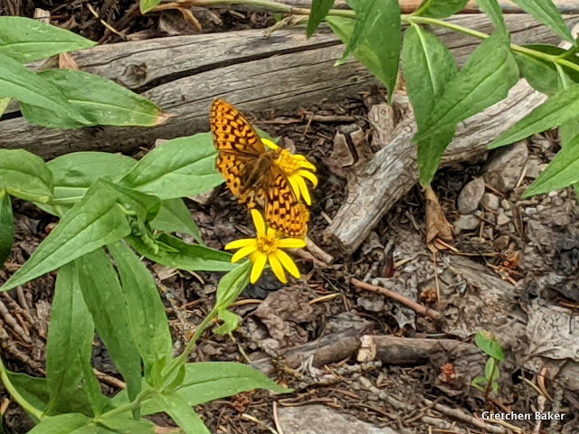
We also saw some butterflies.

My husband remembered a 1903 arborglyph, and we eventually found it. It was nearly illegible.

We moved down a bit farther and got into the 2016 burn. Then we hiked out to the trailhead, where we had left a vehicle.

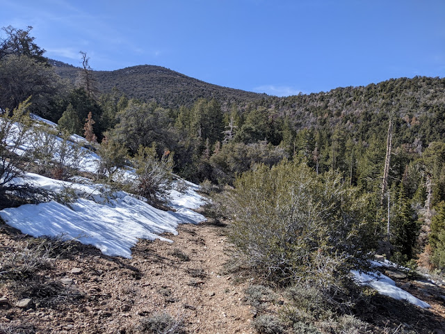
It took about eight hours for the whole trip. It wasn't super hard, but it also wasn't super easy. It was nice to have the uphill part done early in the day and then just keep heading downhill, although with all the obstacles, we certainly got a core workout. I managed to forget my Garmin watch, so I don't have a GPS track of our route. I guess that adds to the mystery of the lost cabin!
Related Posts Plugin for WordPress, Blogger...

blogger templates