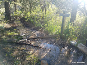
As I started on the Osceola Trail, I found that it was quite wet.
After a short access trail, I was at the ditch, which was built to move water from creeks around the mountain to the mining town of Osceola. This was back in the late 1890s. Many Chinese workers were instrumental in completing the ditch. It was a long ditch over tough terrain, including flumes over rocky sections and even a tunnel. Even more remarkable is that this was the second attempt--they first tried building a ditch on the other side of the mountain, but the creeks over there just didn't have enough water in them.
With the wet winter and spring, the Osceola Ditch has water in it again!
Some sections were quite wet!

Near the beginning is a very rocky part with old wooden support structures.
Before long, you're walking (or jogging) right in the ditch.
Just over a mile from the trailhead is Mill Creek, a small creek with some pretty cascades. It's claim to fame is that it was a refugium creek for Bonneville cutthroat trout. The ditch may have helped save the fish, by giving them a way to swim from Lehman Creek, where non-native fish were stocked and out-competed the Bonneville, to the overlooked Mill Creek.
Not too far after Mill Creek, the trail enters the burned area of Strawberry Creek, which burned in August 2016.
You can find a superbloom of arrowleaf balsamroot (Balsamorhiza saggita) on the hillside.
The burned trees make for some pretty silhouettes.
Rounding a corner, you can see Strawberry Creek down below, with the road near the creek. In the distance is the North Snake Range.
Some sections of the trail are a little rockier. The trail is more of an old road than a ditch at this point.
Post-fire flooding caused a small rock avalanche over part of the trail. It's not hard at all to cross.
There were multiple small streams to step over.
These little streams are the same size as what Strawberry Creek usually is. Passing four or five of them was impressive.
Continuing onward I saw more hillsides of yellow. It was also neat to see the small patches that escaped the fire.
A lone snow bank covered one section of trail. We had gone there the week before with nieces and nephews (from the Strawberry trailhead) and had so much fun sliding on it!
I then took the cutoff trail down to the Strawberry Creek parking area, then jumped across the creek (the pedestrian bridge is out) and headed up the Sage-Steppe trail. More wildflowers abounded!
I kept heading up the trail, finding even more water.
Eventually, after some really steep sections and over 20 downed trees, I reached the pass. The other side is considered Willard Creek.
I had been up there about 17 or 18 years ago and had a faint memory of a two-track road. I found some very faint vestiges of it, but not much. I ran about a half mile on the Willard Creek side, then bushwhacked my way back up to the pass.
These diminutive white flowers were near the pass.
And there were a few snowbanks. The pass is at about 9,000 feet elevation.
Here's the Trail Closed sign on the Upper Strawberry sie.
Another beautiful white flower I need to look up.
In some sections, the trail is nearly grown over with vegetation! The interpretive park rangers have been telling people to go hike the trail, so that might help. On the way back, I saw about 20 people hiking.
It sure is a great trail to hike, especially this time of year when it's cooler and there are so many wildflowers.
It's also a cool experience to walk through the burned area and see how it's recovering.
The parking lot was fuller than I've ever seen it. I sure do recommend this hike! And once the higher country opens, there probably will be more parking available here.


In you article, you mentioned ".....Many Chinese workers were instrumental in completing the ditch....." -- Could you give me some reference regarding this piece of history? Thank you. Frank Lai
ReplyDelete