We were disturbing swarms of moths as we walked, and we saw the green gentian (elkweed) covered with the army cutworm (or "Millers") moths. Due to the mild winter, we've had an outstanding number of them this year.
It was so much fun when we got to a big patch of snow!
Desert Girl had to make a snowwoman. She was very bright in her tech t-shirt and pink tutu. I've long ago decided she can wear whatever she wants as long as she hikes.
Quite a variety of flowers were blooming, lending a nice distraction to the gain of elevation.
As we reached the saddle we found more snow and also a faint trail heading across the backside of the mountain.
The trail kept getting fainter and fainter, but we followed it around to the south end of the mountain (if I did it again, I would head up sooner, because there was no trail at the south end of the mountain).
Desert Girl got a ride up the last part, but Desert Boy had to do it on his own, with some coaxing.
We made it, though! Even our dog Henry got to the top. We carried extra water for him, as there is no water on the hike except if you find snow.
Desert Girl had fallen asleep, so my idea of a family photo on top of the mountain didn't work out. We took a little rest and signed into the register. The register is in stark contrast with the one at Wheeler Peak. More people climb Wheeler Peak in a single day then often climb Mount Moriah all summer. If you want some solitude, this is the place to come!
The views were outstanding. To the north we could see the wide table, and then off in the distance the Deep Creek Mountains, with Ibapah Peak topping out at 12,067 ft.
To the northeast we saw Gandy Salt Marsh and lake, with the Confusion Range and Fish Springs Range beyond.
To the southeast we saw EskDale and the Ferguson Desert.
To the south we saw Jeff Davis and Wheeler Peak and the South Snake Range.
And to the northwest we saw more of the North Snake Range. It really has a different character than the South Snake Range. It's a lot bumpier, for lack of a technical term. (If you'd like to learn about the geology, here's a link to the Nevada Bureau of Mines and Geology Bulletin on the area.) Everywhere we looked we saw swarms of moths.
They wandered off as we got closer, but then one came back to check us out.
Desert Girl woke up and was ready to hike again.
We descended quickly, and soon the peak looked far away up its northwest shoulder.
Before long we were in a limber and bristlecone forest, going down quickly into a meadow. It was steep!
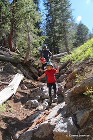
We followed a gully back to the trail, and that part had some fun challenges for the kids.
Finally we made it back (that last part going up hill isn't easy)! It was a longer hike than we expected, with 4.5 miles up and 3.0 miles down and over 2,000 feet total elevation change. Desert Boy hiked the whole thing, and four-year old Desert Girl hiked 5.5 miles of it--she's going to be one awesome hiker. Below is our approximate route, looking south.
It was a great feeling to have accomplished that hike. The only people we saw all weekend were two guys leaving the trailhead area when we pulled in. We had the trail all to ourselves.
Happy hiking!


Hi, I enjoyed your pics of the Table hike you, the kids, and the dog made. It's so cool that you have such young kids along. I believe it will instill a life-long appreciation of the outdoors in them. I lived in Baker, and spent much time on the Table, and surrounding areas, including multi-day, solo backpacking trips. A great and grand place, isn't it?
ReplyDeleteThanks for the blog Gretchen, my wife and I are headed up there tomorrow!
ReplyDelete